Shawan geodata
Shawan (Zhejiang) is a seat of a fourth-order administrative division; located in China in Asia/Shanghai (GMT+8) time zone. In our database, there are 1268 cities with bigger population. Compared to other cities in China, 74.9% of cities are located further ↑North; 78.6% of cities are located further ←West and 67% of cities have lower elevation than Shawan. Note1


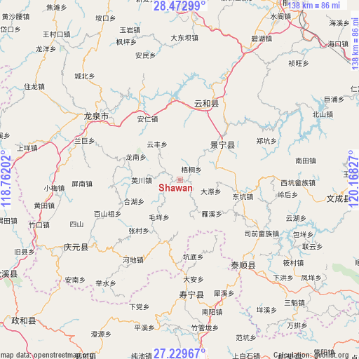
Shawan GPS coordinates[2]
27° 51' 11.196" North, 119° 27' 54.504" East
| Map corner | latitude | longitude |
|---|---|---|
| Upper-left | 28.47299°, | 118.76202° |
| Center: | 27.85311°, | 119.46514° |
| Lower-right: | 27.22967°, | 120.16827° |
| Map W x H: | 138.2×138.2 km | = 85.9×85.9mi |
| max Lat: | 53.31946° ⇑74.9% North |
| Shawan: | 27.85311° |
| min Lat: | ⇓25.1% South 18.22056° |
| min Long | Shawan | max Long |
| 75.07348° | 119.46514° | 134.28917° |
| W 78.6%⇐ | ⇒21.4% E |
Elevation
Elevation of Shawan is 359 m = 1178 ft, and this is 125.8 m = 413 ft below average elevation for this country.
| Max E: |
5622 m = 18445 ft | 33% |
| Avg. | 484.8 m = 1591 ft | |
| Shawan | 359 m = 1178 ft | |
Min E: |
-3 m = -10 ft | 67% |
See also: China elevation on elevation.city.
Geographical zone
Shawan is located in North temperate zone (between Tropic of Cancer and the Arctic Circle). Distance of this Northern Tropic circle is 491.1 km =305.2 mi to South.| Distance of | km | miles | from Shawan |
|---|---|---|---|
| North Pole | 6910.1 | 4293.7 | to North |
| Arctic Circle | 4304.2 | 2674.5 | to North |
| Tropic Cancer | 491.1 | 305.2 | to South |
| Equator | 3097 | 1924.4 | to South |


Nearby cities:
15 places around Shawan: (largest is in red/bold)
• Biaoxi
3.2 km =2 mi,  92°
92°
• Chengzhao
17 km =10.6 mi,  62°
62°
• Dadi
9.7 km =6 mi,  183°
183°
• Daji
12.6 km =7.8 mi,  110°
110°
• Dajun
14.7 km =9.1 mi,  40°
40°
• Geshan
12.3 km =7.6 mi,  290°
290°
• Jiadi
16 km =9.9 mi,  159°
159°
• Longnan
19.1 km =11.9 mi,  298°
298°
• Luci
6.7 km =4.2 mi, 293°
• Maoyang
16.4 km =10.2 mi,  209°
209°
• Qiulu
18.3 km =11.4 mi,  219°
219°
• Wutong
6 km =3.7 mi,  47°
47°
• Yanxi
18.3 km =11.4 mi,  135°
135°
• Yingchuan
14.7 km =9.1 mi,  269°
269°
• Yunfeng
16.4 km =10.2 mi,  327°
327°
Sources, notices
• [Note1] Compared only with cities in China existing in our database
• [Src1] Map data: © OpenStreetMap contributors (CC-BY-SA)
• [Src2] Other city data from geonames.org with taken over terms of usage.
• [Src3] Geographical zone / Annual Mean Temperature by Robert A. Rohde @ Wikipedia
