Shuangtou geodata
Shuangtou (Guangdong) is a seat of a fourth-order administrative division; located in China in Asia/Shanghai (GMT+8) time zone. In our database, there are 1268 cities with bigger population. Compared to other cities in China, 90.4% of cities are located further ↑North; 56.9% of cities are located further ←West and 53.4% of cities have lower elevation than Shuangtou. Note1


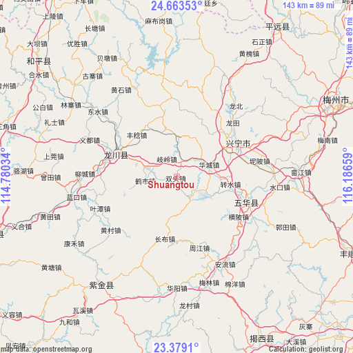
Shuangtou GPS coordinates[2]
24° 1' 22.512" North, 115° 29' 0.456" East
| Map corner | latitude | longitude |
|---|---|---|
| Upper-left | 24.66353°, | 114.78034° |
| Center: | 24.02292°, | 115.48346° |
| Lower-right: | 23.3791°, | 116.18659° |
| Map W x H: | 142.8×142.8 km | = 88.7×88.7mi |
| max Lat: | 53.31946° ⇑90.4% North |
| Shuangtou: | 24.02292° |
| min Lat: | ⇓9.6% South 18.22056° |
| min Long | Shuangtou | max Long |
| 75.07348° | 115.48346° | 134.28917° |
| W 56.9%⇐ | ⇒43.1% E |
Elevation
Elevation of Shuangtou is 192 m = 630 ft, and this is 292.8 m = 961 ft below average elevation for this country.
| Max E: |
5622 m = 18445 ft | 46.6% |
| Avg. | 484.8 m = 1591 ft | |
| Shuangtou | 192 m = 630 ft | |
Min E: |
-3 m = -10 ft | 53.4% |
See also: China elevation on elevation.city.
Geographical zone
Shuangtou is located in North temperate zone (between Tropic of Cancer and the Arctic Circle). Distance of this Northern Tropic circle is 65.2 km =40.5 mi to South.| Distance of | km | miles | from Shuangtou |
|---|---|---|---|
| North Pole | 7336 | 4558.4 | to North |
| Arctic Circle | 4730.1 | 2939.1 | to North |
| Tropic Cancer | 65.2 | 40.5 | to South |
| Equator | 2671.1 | 1659.7 | to South |


Nearby cities:
15 places around Shuangtou: (largest is in red/bold)
• Datian
18.7 km =11.6 mi,  191°
191°
• Dengyun
10.5 km =6.5 mi,  299°
299°
• Fengren
23.1 km =14.4 mi,  316°
316°
• Guqian
18.7 km =11.6 mi,  341°
341°
• Heshi
12.7 km =7.9 mi,  262°
262°
• Huacheng
14 km =8.7 mi,  69°
69°
• Huangbu
19.3 km =12 mi, 255°
• Qiling
8.4 km =5.2 mi,  334°
334°
• Shizikeng
10.8 km =6.7 mi,  310°
310°
• Tanxia
10.1 km =6.3 mi,  148°
148°
• Tiechang
15.8 km =9.8 mi,  2°
2°
• Tongqu
11.3 km =7 mi,  284°
284°
• Xinqiao
16.8 km =10.4 mi,  30°
30°
• Zhuanshui
21.8 km =13.5 mi,  96°
96°
• Zishi
16.8 km =10.4 mi,  233°
233°
Sources, notices
• [Note1] Compared only with cities in China existing in our database
• [Src1] Map data: © OpenStreetMap contributors (CC-BY-SA)
• [Src2] Other city data from geonames.org with taken over terms of usage.
• [Src3] Geographical zone / Annual Mean Temperature by Robert A. Rohde @ Wikipedia
