Dongkeng geodata
Dongkeng (Guangdong) is a seat of a fourth-order administrative division; located in China in Asia/Shanghai (GMT+8) time zone. In our database, there are 1268 cities with bigger population. Compared to other cities in China, 93.1% of cities are located further ↑North; 58.2% of cities are located further ←West and 50.8% of cities have lower elevation than Dongkeng. Note1


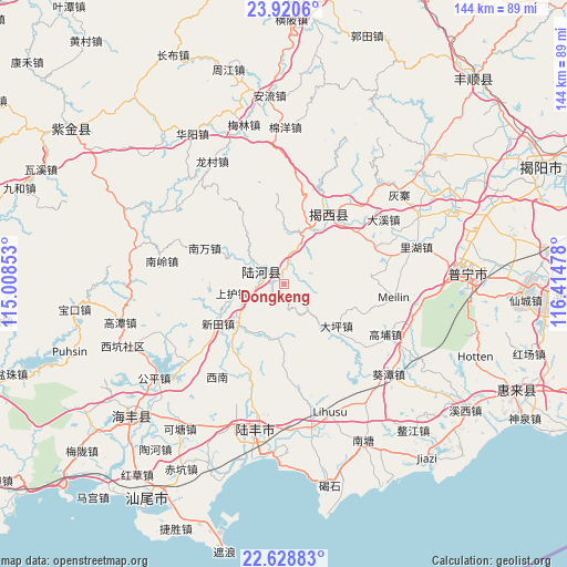
Dongkeng GPS coordinates[2]
23° 16' 34.608" North, 115° 42' 41.94" East
| Map corner | latitude | longitude |
|---|---|---|
| Upper-left | 23.9206°, | 115.00853° |
| Center: | 23.27628°, | 115.71165° |
| Lower-right: | 22.62883°, | 116.41478° |
| Map W x H: | 143.6×143.6 km | = 89.2×89.2mi |
| max Lat: | 53.31946° ⇑93.1% North |
| Dongkeng: | 23.27628° |
| min Lat: | ⇓6.9% South 18.22056° |
| min Long | Dongkeng | max Long |
| 75.07348° | 115.71165° | 134.28917° |
| W 58.2%⇐ | ⇒41.8% E |
Elevation
Elevation of Dongkeng is 172 m = 564 ft, and this is 312.8 m = 1026 ft below average elevation for this country.
| Max E: |
5622 m = 18445 ft | 49.2% |
| Avg. | 484.8 m = 1591 ft | |
| Dongkeng | 172 m = 564 ft | |
Min E: |
-3 m = -10 ft | 50.8% |
See also: China elevation on elevation.city.
Geographical zone
Dongkeng is located in North Torrid zone (between Equator and Tropic of Cancer). Distance of this Northern Tropic circle is 17.8 km =11.1 mi to North.| Distance of | km | miles | from Dongkeng |
|---|---|---|---|
| North Pole | 7419 | 4610 | to North |
| Arctic Circle | 4813.1 | 2990.7 | to North |
| Tropic Cancer | 17.8 | 11.1 | to North |
| Equator | 2588.1 | 1608.2 | to South |


Nearby cities:
15 places around Dongkeng: (largest is in red/bold)
• Chuanpu
19.1 km =11.9 mi,  107°
107°
• Daping
17.7 km =11 mi,  127°
127°
• Da’an
24.3 km =15.1 mi,  198°
198°
• Hekou
15.2 km =9.4 mi,  224°
224°
• Hepo
21 km =13 mi,  35°
35°
• Hetian
6.2 km =3.9 mi,  296°
296°
• Longtan
25.5 km =15.8 mi, 40°
• Luoxi
14.6 km =9.1 mi,  319°
319°
• Nanwan
22.2 km =13.8 mi,  291°
291°
• Pingshang
22.9 km =14.2 mi,  52°
52°
• Shanghu
12.6 km =7.8 mi,  259°
259°
• Shangsha
22.3 km =13.9 mi,  355°
355°
• Shuichun
5.1 km =3.2 mi,  31°
31°
• Wuyun
15 km =9.3 mi, 27°
• Xintian
19.4 km =12.1 mi,  238°
238°
Sources, notices
• [Note1] Compared only with cities in China existing in our database
• [Src1] Map data: © OpenStreetMap contributors (CC-BY-SA)
• [Src2] Other city data from geonames.org with taken over terms of usage.
• [Src3] Geographical zone / Annual Mean Temperature by Robert A. Rohde @ Wikipedia
