Tangtou geodata
Tangtou (Fujian) is a seat of a fourth-order administrative division; located in China in Asia/Shanghai (GMT+8) time zone. In our database, there are 1268 cities with bigger population. Compared to other cities in China, 83.1% of cities are located further ↑North; 71.2% of cities are located further ←West and 83.4% of cities have lower elevation than Tangtou. Note1


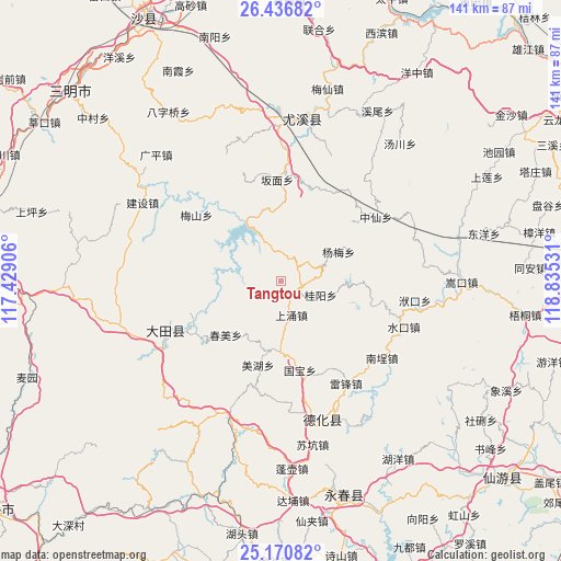
Tangtou GPS coordinates[2]
25° 48' 19.836" North, 118° 7' 55.848" East
| Map corner | latitude | longitude |
|---|---|---|
| Upper-left | 26.43682°, | 117.42906° |
| Center: | 25.80551°, | 118.13218° |
| Lower-right: | 25.17082°, | 118.83531° |
| Map W x H: | 140.8×140.8 km | = 87.5×87.5mi |
| max Lat: | 53.31946° ⇑83.1% North |
| Tangtou: | 25.80551° |
| min Lat: | ⇓16.9% South 18.22056° |
| min Long | Tangtou | max Long |
| 75.07348° | 118.13218° | 134.28917° |
| W 71.2%⇐ | ⇒28.8% E |
Elevation
Elevation of Tangtou is 876 m = 2874 ft, and this is 391.2 m = 1283 ft above average elevation for this country.
| Max E: |
5622 m = 18445 ft | 16.6% |
| Tangtou | 876 m 2874 ft | |
| Avg. | 484.8 m = 1591 ft | |
Min E: |
-3 m = -10 ft | 83.4% |
See also: China elevation on elevation.city.
Geographical zone
Tangtou is located in North temperate zone (between Tropic of Cancer and the Arctic Circle). Distance of this Northern Tropic circle is 263.4 km =163.7 mi to South.| Distance of | km | miles | from Tangtou |
|---|---|---|---|
| North Pole | 7137.8 | 4435.2 | to North |
| Arctic Circle | 4531.9 | 2816 | to North |
| Tropic Cancer | 263.4 | 163.7 | to South |
| Equator | 2869.3 | 1782.9 | to South |


Nearby cities:
15 places around Tangtou: (largest is in red/bold)
• Banmian
25.5 km =15.8 mi,  357°
357°
• Chishui
17.8 km =11.1 mi,  181°
181°
• Chunmei
19.2 km =11.9 mi,  226°
226°
• Daming
13.8 km =8.6 mi,  202°
202°
• Gekeng
8.3 km =5.2 mi,  56°
56°
• Guiyang
10.3 km =6.4 mi,  111°
111°
• Guobao
22.2 km =13.8 mi,  168°
168°
• Huaxing
27.6 km =17.1 mi,  243°
243°
• Humei
19.9 km =12.4 mi,  266°
266°
• Leifeng
30.2 km =18.8 mi,  147°
147°
• Meihu
21.8 km =13.5 mi,  193°
193°
• Meishan
27.2 km =16.9 mi,  307°
307°
• Qianping
27.2 km =16.9 mi,  279°
279°
• Shangyong
8.3 km =5.2 mi,  162°
162°
• Zhongxian
28.8 km =17.9 mi, 55°
Sources, notices
• [Note1] Compared only with cities in China existing in our database
• [Src1] Map data: © OpenStreetMap contributors (CC-BY-SA)
• [Src2] Other city data from geonames.org with taken over terms of usage.
• [Src3] Geographical zone / Annual Mean Temperature by Robert A. Rohde @ Wikipedia
