Zhongxian geodata
Zhongxian (Fujian) is a seat of a fourth-order administrative division; located in China in Asia/Shanghai (GMT+8) time zone. In our database, there are 1268 cities with bigger population. Compared to other cities in China, 82.6% of cities are located further ↑North; 72.4% of cities are located further ←West and 79.7% of cities have lower elevation than Zhongxian. Note1


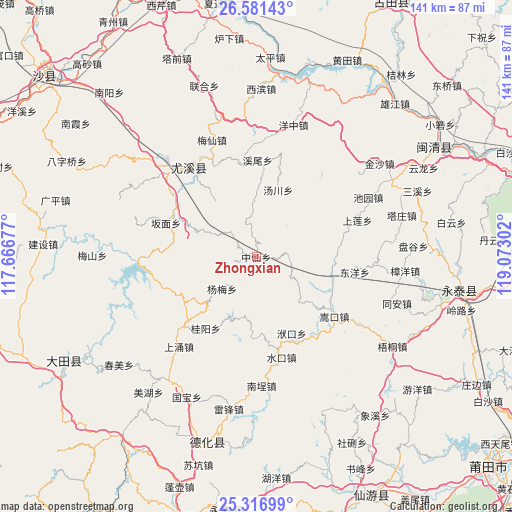
Zhongxian GPS coordinates[2]
25° 57' 3.276" North, 118° 22' 11.604" East
| Map corner | latitude | longitude |
|---|---|---|
| Upper-left | 26.58143°, | 117.66677° |
| Center: | 25.95091°, | 118.36989° |
| Lower-right: | 25.31699°, | 119.07302° |
| Map W x H: | 140.6×140.6 km | = 87.4×87.4mi |
| max Lat: | 53.31946° ⇑82.6% North |
| Zhongxian: | 25.95091° |
| min Lat: | ⇓17.4% South 18.22056° |
| min Long | Zhongxian | max Long |
| 75.07348° | 118.36989° | 134.28917° |
| W 72.4%⇐ | ⇒27.6% E |
Elevation
Elevation of Zhongxian is 680 m = 2231 ft, and this is 195.2 m = 640 ft above average elevation for this country.
| Max E: |
5622 m = 18445 ft | 20.3% |
| Zhongxian | 680 m 2231 ft | |
| Avg. | 484.8 m = 1591 ft | |
Min E: |
-3 m = -10 ft | 79.7% |
See also: China elevation on elevation.city.
Geographical zone
Zhongxian is located in North temperate zone (between Tropic of Cancer and the Arctic Circle). Distance of this Northern Tropic circle is 279.6 km =173.7 mi to South.| Distance of | km | miles | from Zhongxian |
|---|---|---|---|
| North Pole | 7121.6 | 4425.2 | to North |
| Arctic Circle | 4515.7 | 2805.9 | to North |
| Tropic Cancer | 279.6 | 173.7 | to South |
| Equator | 2885.5 | 1793 | to South |


Nearby cities:
15 places around Zhongxian: (largest is in red/bold)
• Banmian
26.6 km =16.5 mi,  290°
290°
• Changqing
22.3 km =13.9 mi,  109°
109°
• Dongyang
27.4 km =17 mi,  98°
98°
• Fukou
23.1 km =14.4 mi,  154°
154°
• Gaiyang
16.7 km =10.4 mi,  136°
136°
• Gekeng
20.4 km =12.7 mi,  235°
235°
• Guiyang
24.4 km =15.2 mi,  215°
215°
• Houjia
20.3 km =12.6 mi,  61°
61°
• Jiatou
25.6 km =15.9 mi,  68°
68°
• Shuikou
27.3 km =17 mi,  167°
167°
• Songkou
27 km =16.8 mi,  127°
127°
• Taixi
20.8 km =12.9 mi,  323°
323°
• Tangchuan
19 km =11.8 mi,  17°
17°
• Tangtou
28.8 km =17.9 mi, 235°
• Xiwei
26.6 km =16.5 mi,  0°
0°
Sources, notices
• [Note1] Compared only with cities in China existing in our database
• [Src1] Map data: © OpenStreetMap contributors (CC-BY-SA)
• [Src2] Other city data from geonames.org with taken over terms of usage.
• [Src3] Geographical zone / Annual Mean Temperature by Robert A. Rohde @ Wikipedia
