Qingxi geodata
Qingxi (Jiangxi) is a seat of a fourth-order administrative division; located in China in Asia/Shanghai (GMT+8) time zone. In our database, there are 1268 cities with bigger population. Compared to other cities in China, 85.4% of cities are located further ↑North; 57.6% of cities are located further ←West and 75.4% of cities have lower elevation than Qingxi. Note1


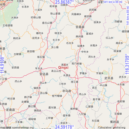
Qingxi GPS coordinates[2]
25° 13' 46.164" North, 115° 36' 50.112" East
| Map corner | latitude | longitude |
|---|---|---|
| Upper-left | 25.86387°, | 114.9108° |
| Center: | 25.22949°, | 115.61392° |
| Lower-right: | 24.59178°, | 116.31705° |
| Map W x H: | 141.4×141.4 km | = 87.9×87.9mi |
| max Lat: | 53.31946° ⇑85.4% North |
| Qingxi: | 25.22949° |
| min Lat: | ⇓14.6% South 18.22056° |
| min Long | Qingxi | max Long |
| 75.07348° | 115.61392° | 134.28917° |
| W 57.6%⇐ | ⇒42.4% E |
Elevation
Elevation of Qingxi is 530 m = 1739 ft, and this is 45.2 m = 148 ft above average elevation for this country.
| Max E: |
5622 m = 18445 ft | 24.6% |
| Qingxi | 530 m 1739 ft | |
| Avg. | 484.8 m = 1591 ft | |
Min E: |
-3 m = -10 ft | 75.4% |
See also: China elevation on elevation.city.
Geographical zone
Qingxi is located in North temperate zone (between Tropic of Cancer and the Arctic Circle). Distance of this Northern Tropic circle is 199.3 km =123.8 mi to South.| Distance of | km | miles | from Qingxi |
|---|---|---|---|
| North Pole | 7201.8 | 4475 | to North |
| Arctic Circle | 4595.9 | 2855.8 | to North |
| Tropic Cancer | 199.3 | 123.8 | to South |
| Equator | 2805.3 | 1743.1 | to South |


Nearby cities:
15 places around Qingxi: (largest is in red/bold)
• Caifang
18.7 km =11.6 mi,  294°
294°
• Changling
18.9 km =11.7 mi,  84°
84°
• Chengjiang
21.6 km =13.4 mi,  150°
150°
• Gaoyunshan
11.4 km =7.1 mi,  234°
234°
• Lianjiang
24.8 km =15.4 mi,  243°
243°
• Luoshan
22.5 km =14 mi,  114°
114°
• Sanbiao
21 km =13 mi,  186°
186°
• Shuiyuan
11.7 km =7.3 mi,  168°
168°
• Tianxin
21.7 km =13.5 mi,  329°
329°
• Xinshan
25 km =15.5 mi,  245°
245°
• Youshui
24.4 km =15.2 mi,  13°
13°
• Yunmenling
13.2 km =8.2 mi, 84°
• Zhongcun
26.4 km =16.4 mi,  57°
57°
• Zhongshi
26.5 km =16.5 mi,  311°
311°
• Zhoutian
15.9 km =9.9 mi,  46°
46°
Sources, notices
• [Note1] Compared only with cities in China existing in our database
• [Src1] Map data: © OpenStreetMap contributors (CC-BY-SA)
• [Src2] Other city data from geonames.org with taken over terms of usage.
• [Src3] Geographical zone / Annual Mean Temperature by Robert A. Rohde @ Wikipedia
