Shehou geodata
Shehou (Jiangxi) is a seat of a fourth-order administrative division; located in China in Asia/Shanghai (GMT+8) time zone. In our database, there are 1268 cities with bigger population. Compared to other cities in China, 69.9% of cities are located further ↑North; 72.4% of cities are located further ←West and 61.9% of cities have lower elevation than Shehou. Note1


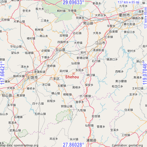
Shehou GPS coordinates[2]
28° 28' 48.396" North, 118° 22' 2.388" East
| Map corner | latitude | longitude |
|---|---|---|
| Upper-left | 29.09633°, | 117.66421° |
| Center: | 28.48011°, | 118.36733° |
| Lower-right: | 27.86028°, | 119.07046° |
| Map W x H: | 137.4×137.4 km | = 85.4×85.4mi |
| max Lat: | 53.31946° ⇑69.9% North |
| Shehou: | 28.48011° |
| min Lat: | ⇓30.1% South 18.22056° |
| min Long | Shehou | max Long |
| 75.07348° | 118.36733° | 134.28917° |
| W 72.4%⇐ | ⇒27.6% E |
Elevation
Elevation of Shehou is 282 m = 925 ft, and this is 202.8 m = 665 ft below average elevation for this country.
| Max E: |
5622 m = 18445 ft | 38.1% |
| Avg. | 484.8 m = 1591 ft | |
| Shehou | 282 m = 925 ft | |
Min E: |
-3 m = -10 ft | 61.9% |
See also: China elevation on elevation.city.
Geographical zone
Shehou is located in North temperate zone (between Tropic of Cancer and the Arctic Circle). Distance of this Northern Tropic circle is 560.8 km =348.5 mi to South.| Distance of | km | miles | from Shehou |
|---|---|---|---|
| North Pole | 6840.4 | 4250.4 | to North |
| Arctic Circle | 4234.5 | 2631.2 | to North |
| Tropic Cancer | 560.8 | 348.5 | to South |
| Equator | 3166.7 | 1967.7 | to South |


Nearby cities:
15 places around Shehou: (largest is in red/bold)
• Danan
14.2 km =8.8 mi,  302°
302°
• Dashi
17.4 km =10.8 mi,  240°
240°
• Fenglin
13.7 km =8.5 mi,  69°
69°
• Guancun
5.6 km =3.5 mi,  94°
94°
• Huacun
13.9 km =8.6 mi,  329°
329°
• Maocun
9.6 km =6 mi,  181°
181°
• Maofan
13.5 km =8.4 mi,  58°
58°
• Paishan
8.9 km =5.5 mi,  255°
255°
• Quanbo
11.5 km =7.1 mi,  196°
196°
• Songfeng
13.6 km =8.5 mi,  169°
169°
• Wucun
9.1 km =5.7 mi,  283°
283°
• Xianyan
10.7 km =6.6 mi,  14°
14°
• Xiaxi
17.8 km =11.1 mi, 262°
• Xintangbian
17.8 km =11.1 mi,  27°
27°
• Yongfeng
16.5 km =10.3 mi,  245°
245°
Sources, notices
• [Note1] Compared only with cities in China existing in our database
• [Src1] Map data: © OpenStreetMap contributors (CC-BY-SA)
• [Src2] Other city data from geonames.org with taken over terms of usage.
• [Src3] Geographical zone / Annual Mean Temperature by Robert A. Rohde @ Wikipedia
