Shixia geodata
Shixia (Jiangxi) is a seat of a fourth-order administrative division; located in China in Asia/Shanghai (GMT+8) time zone. In our database, there are 1268 cities with bigger population. Compared to other cities in China, 75.9% of cities are located further ↑North; 65.5% of cities are located further ←West and 51.3% of cities have lower elevation than Shixia. Note1


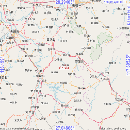
Shixia GPS coordinates[2]
27° 40' 23.232" North, 116° 54' 7.632" East
| Map corner | latitude | longitude |
|---|---|---|
| Upper-left | 28.29403°, | 116.199° |
| Center: | 27.67312°, | 116.90212° |
| Lower-right: | 27.04866°, | 117.60525° |
| Map W x H: | 138.5×138.5 km | = 86.1×86.1mi |
| max Lat: | 53.31946° ⇑75.9% North |
| Shixia: | 27.67312° |
| min Lat: | ⇓24.1% South 18.22056° |
| min Long | Shixia | max Long |
| 75.07348° | 116.90212° | 134.28917° |
| W 65.5%⇐ | ⇒34.5% E |
Elevation
Elevation of Shixia is 175 m = 574 ft, and this is 309.8 m = 1016 ft below average elevation for this country.
| Max E: |
5622 m = 18445 ft | 48.7% |
| Avg. | 484.8 m = 1591 ft | |
| Shixia | 175 m = 574 ft | |
Min E: |
-3 m = -10 ft | 51.3% |
See also: China elevation on elevation.city.
Geographical zone
Shixia is located in North temperate zone (between Tropic of Cancer and the Arctic Circle). Distance of this Northern Tropic circle is 471 km =292.7 mi to South.| Distance of | km | miles | from Shixia |
|---|---|---|---|
| North Pole | 6930.1 | 4306.2 | to North |
| Arctic Circle | 4324.2 | 2686.9 | to North |
| Tropic Cancer | 471 | 292.7 | to South |
| Equator | 3077 | 1912 | to South |


Nearby cities:
15 places around Shixia: (largest is in red/bold)
• Gaotian
11.3 km =7 mi,  332°
332°
• Heyuan
36.2 km =22.5 mi,  7°
7°
• Hongmen
27.6 km =17.1 mi,  223°
223°
• Jianchang
28.8 km =17.9 mi,  243°
243°
• Lengshui
38.2 km =23.7 mi,  46°
46°
• Lufang
38.4 km =23.9 mi,  347°
347°
• Shazhou
9.8 km =6.1 mi,  309°
309°
• Shimen
26.7 km =16.6 mi,  296°
296°
• Songshi
11.3 km =7 mi, 6°
• Tianjingyuan
29.6 km =18.4 mi, 237°
• Wanfang
28.9 km =18 mi,  257°
257°
• Xiugu
29.2 km =18.1 mi, 334°
• Xujia
21 km =13 mi, 262°
• Zhuliang
37.4 km =23.2 mi,  232°
232°
• Zuofang
22.4 km =13.9 mi,  318°
318°
Sources, notices
• [Note1] Compared only with cities in China existing in our database
• [Src1] Map data: © OpenStreetMap contributors (CC-BY-SA)
• [Src2] Other city data from geonames.org with taken over terms of usage.
• [Src3] Geographical zone / Annual Mean Temperature by Robert A. Rohde @ Wikipedia
