Zhaozhou geodata
Zhaozhou (Heilongjiang) is a populated place; located in China in Asia/Shanghai (GMT+8) time zone. With population of 62,373 people, there are 691 cities with bigger population in this country. Compared to other cities in China, 94.6% of cities are located further ↓South; 94.9% of cities are located further ←West and 51.6% of cities have higher elevation than Zhaozhou. Note1


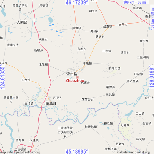
Zhaozhou GPS coordinates[2]
45° 40' 59.988" North, 125° 19' 0.012" East
| Map corner | latitude | longitude |
|---|---|---|
| Upper-left | 46.17239°, | 124.61355° |
| Center: | 45.68333°, | 125.31667° |
| Lower-right: | 45.18995°, | 126.0198° |
| Map W x H: | 109.2×109.2 km | = 67.9×67.9mi |
| max Lat: | 53.31946° ⇑5.4% North |
| Zhaozhou: | 45.68333° |
| min Lat: | ⇓94.6% South 18.22056° |
| min Long | Zhaozhou | max Long |
| 75.07348° | 125.31667° | 134.28917° |
| W 94.9%⇐ | ⇒5.1% E |
Elevation
Elevation of Zhaozhou is 152 m = 499 ft, and this is 332.8 m = 1092 ft below average elevation for this country.
| Max E: |
5622 m = 18445 ft | 51.6% |
| Avg. | 484.8 m = 1591 ft | |
| Zhaozhou | 152 m = 499 ft | |
Min E: |
-3 m = -10 ft | 48.4% |
See also: Zhaozhou elevation on elevation.city.
Geographical zone
Zhaozhou is located in North temperate zone (between Tropic of Cancer and the Arctic Circle). Distance of this North polar circle is 2321.7 km =1442.6 mi to North.| Distance of | km | miles | from Zhaozhou |
|---|---|---|---|
| North Pole | 4927.6 | 3061.9 | to North |
| Arctic Circle | 2321.7 | 1442.6 | to North |
| Tropic Cancer | 2473.6 | 1537 | to South |
| Equator | 5079.5 | 3156.3 | to South |


Nearby cities:
15 places around Zhaozhou: (largest is in red/bold)
• Anmin
56.3 km =35 mi,  12°
12°
• Bajingzi
59.1 km =36.7 mi,  309°
309°
• Changde
56 km =34.8 mi,  335°
335°
• Datong
55.3 km =34.4 mi, 314°
• Fuyu
67.9 km =42.2 mi,  215°
215°
• Gaotaizi
64.2 km =39.9 mi,  320°
320°
• Mingjiu
50.5 km =31.4 mi,  18°
18°
• Shangjia
65 km =40.4 mi,  41°
41°
• Shengping
59.2 km =36.8 mi,  356°
356°
• Songyuan
72.5 km =45 mi,  211°
211°
• Songzhan
64.4 km =40 mi, 21°
• Xuanhua
70.5 km =43.8 mi, 22°
• Yangcao
72.5 km =45 mi, 6°
• Zhaodong
67 km =41.6 mi,  50°
50°
• Zhaoyuan
24.9 km =15.5 mi, 214°
Sources, notices
• [Note1] Compared only with cities in China existing in our database
• [Src1] Map data: © OpenStreetMap contributors (CC-BY-SA)
• [Src2] Other city data from geonames.org with taken over terms of usage.
• [Src3] Geographical zone / Annual Mean Temperature by Robert A. Rohde @ Wikipedia
