Shangjia geodata
Shangjia (Heilongjiang) is a seat of a fourth-order administrative division; located in China in Asia/Shanghai (GMT+8) time zone. In our database, there are 1268 cities with bigger population. Compared to other cities in China, 95.2% of cities are located further ↓South; 95.4% of cities are located further ←West and 53.5% of cities have higher elevation than Shangjia. Note1


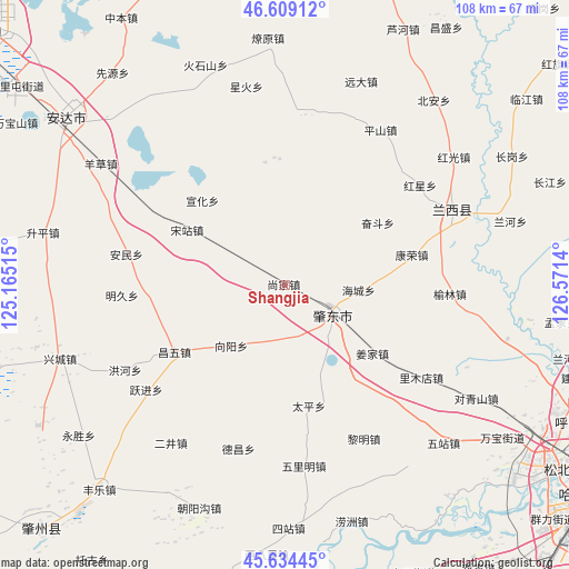
Shangjia GPS coordinates[2]
46° 7' 26.184" North, 125° 52' 5.772" East
| Map corner | latitude | longitude |
|---|---|---|
| Upper-left | 46.60912°, | 125.16515° |
| Center: | 46.12394°, | 125.86827° |
| Lower-right: | 45.63445°, | 126.5714° |
| Map W x H: | 108.4×108.4 km | = 67.4×67.4mi |
| max Lat: | 53.31946° ⇑4.8% North |
| Shangjia: | 46.12394° |
| min Lat: | ⇓95.2% South 18.22056° |
| min Long | Shangjia | max Long |
| 75.07348° | 125.86827° | 134.28917° |
| W 95.4%⇐ | ⇒4.6% E |
Elevation
Elevation of Shangjia is 140 m = 459 ft, and this is 344.8 m = 1131 ft below average elevation for this country.
| Max E: |
5622 m = 18445 ft | 53.5% |
| Avg. | 484.8 m = 1591 ft | |
| Shangjia | 140 m = 459 ft | |
Min E: |
-3 m = -10 ft | 46.5% |
See also: China elevation on elevation.city.
Geographical zone
Shangjia is located in North temperate zone (between Tropic of Cancer and the Arctic Circle). Distance of this North polar circle is 2272.7 km =1412.2 mi to North.| Distance of | km | miles | from Shangjia |
|---|---|---|---|
| North Pole | 4878.6 | 3031.4 | to North |
| Arctic Circle | 2272.7 | 1412.2 | to North |
| Tropic Cancer | 2522.6 | 1567.5 | to South |
| Equator | 5128.5 | 3186.7 | to South |


Nearby cities:
15 places around Shangjia: (largest is in red/bold)
• Anmin
30.7 km =19.1 mi,  281°
281°
• Hongguang
40.4 km =25.1 mi,  52°
52°
• Hongxing
32.1 km =19.9 mi, 53°
• Huoshishan
44.4 km =27.6 mi,  340°
340°
• Kangrong
30.4 km =18.9 mi,  75°
75°
• Lanxi
35.2 km =21.9 mi,  64°
64°
• Mingjiu
26.8 km =16.7 mi,  267°
267°
• Pingshan
34.6 km =21.5 mi,  31°
31°
• Songzhan
21.6 km =13.4 mi,  300°
300°
• Xinghuo
38.5 km =23.9 mi,  348°
348°
• Xuanhua
22.5 km =14 mi,  315°
315°
• Yangcao
41.8 km =26 mi, 303°
• Yuanda
41.2 km =25.6 mi,  20°
20°
• Yulin
31.6 km =19.6 mi,  92°
92°
• Zhaodong
10.8 km =6.7 mi,  125°
125°
Sources, notices
• [Note1] Compared only with cities in China existing in our database
• [Src1] Map data: © OpenStreetMap contributors (CC-BY-SA)
• [Src2] Other city data from geonames.org with taken over terms of usage.
• [Src3] Geographical zone / Annual Mean Temperature by Robert A. Rohde @ Wikipedia
