Yushu geodata
Yushu (Jilin) is a populated place; located in China in Asia/Shanghai (GMT+8) time zone. With population of 124,736 people, there are 353 cities with bigger population in this country. Compared to other cities in China, 93.7% of cities are located further ↓South; 96.1% of cities are located further ←West and 56.4% of cities have lower elevation than Yushu. Note1


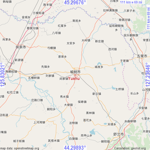
Yushu GPS coordinates[2]
44° 48' 0" North, 126° 31' 59.988" East
| Map corner | latitude | longitude |
|---|---|---|
| Upper-left | 45.29676°, | 125.83021° |
| Center: | 44.8°, | 126.53333° |
| Lower-right: | 44.29893°, | 127.23646° |
| Map W x H: | 110.9×110.9 km | = 68.9×68.9mi |
| max Lat: | 53.31946° ⇑6.3% North |
| Yushu: | 44.8° |
| min Lat: | ⇓93.7% South 18.22056° |
| min Long | Yushu | max Long |
| 75.07348° | 126.53333° | 134.28917° |
| W 96.1%⇐ | ⇒3.9% E |
Elevation
Elevation of Yushu is 220 m = 722 ft, and this is 264.8 m = 869 ft below average elevation for this country.
| Max E: |
5622 m = 18445 ft | 43.6% |
| Avg. | 484.8 m = 1591 ft | |
| Yushu | 220 m = 722 ft | |
Min E: |
-3 m = -10 ft | 56.4% |
See also: Yushu elevation on elevation.city.
Geographical zone
Yushu is located in North temperate zone (between Tropic of Cancer and the Arctic Circle). Distance of this Northern Tropic circle is 2375.4 km =1476 mi to South.| Distance of | km | miles | from Yushu |
|---|---|---|---|
| North Pole | 5025.8 | 3122.9 | to North |
| Arctic Circle | 2419.9 | 1503.7 | to North |
| Tropic Cancer | 2375.4 | 1476 | to South |
| Equator | 4981.3 | 3095.2 | to South |


Nearby cities:
15 places around Yushu: (largest is in red/bold)
• Anjia
50.5 km =31.4 mi,  56°
56°
• Bajiazi
62.2 km =38.6 mi,  39°
39°
• Beiyinhe
54.9 km =34.1 mi, 41°
• Changbao
59.3 km =36.8 mi, 63°
• Jishu
57.7 km =35.9 mi,  158°
158°
• Minyi
61.8 km =38.4 mi,  76°
76°
• Minyue
49.3 km =30.6 mi, 55°
• Qingshan
43.2 km =26.8 mi, 41°
• Sanchahe
44.7 km =27.8 mi,  293°
293°
• Shuangcheng
64.2 km =39.9 mi,  342°
342°
• Shulan
53.9 km =33.5 mi,  142°
142°
• Wuchang
50.2 km =31.2 mi, 75°
• Xinglong
62.6 km =38.9 mi,  27°
27°
• Yanhe
46.5 km =28.9 mi, 40°
• Yingchengzi
52.7 km =32.7 mi, 39°
Sources, notices
• [Note1] Compared only with cities in China existing in our database
• [Src1] Map data: © OpenStreetMap contributors (CC-BY-SA)
• [Src2] Other city data from geonames.org with taken over terms of usage.
• [Src3] Geographical zone / Annual Mean Temperature by Robert A. Rohde @ Wikipedia
