Shulan geodata
Shulan (Jilin) is a populated place; located in China in Asia/Shanghai (GMT+8) time zone. With population of 77,420 people, there are 554 cities with bigger population in this country. Compared to other cities in China, 93.3% of cities are located further ↓South; 96.6% of cities are located further ←West and 57.7% of cities have lower elevation than Shulan. Note1


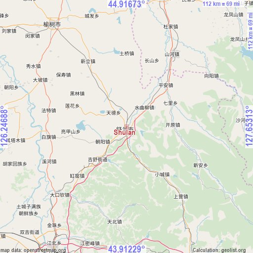
Shulan GPS coordinates[2]
44° 25' 0.012" North, 126° 57' 0" East
| Map corner | latitude | longitude |
|---|---|---|
| Upper-left | 44.91673°, | 126.24688° |
| Center: | 44.41667°, | 126.95° |
| Lower-right: | 43.91229°, | 127.65313° |
| Map W x H: | 111.7×111.7 km | = 69.4×69.4mi |
| max Lat: | 53.31946° ⇑6.7% North |
| Shulan: | 44.41667° |
| min Lat: | ⇓93.3% South 18.22056° |
| min Long | Shulan | max Long |
| 75.07348° | 126.95° | 134.28917° |
| W 96.6%⇐ | ⇒3.4% E |
Elevation
Elevation of Shulan is 233 m = 764 ft, and this is 251.8 m = 826 ft below average elevation for this country.
| Max E: |
5622 m = 18445 ft | 42.3% |
| Avg. | 484.8 m = 1591 ft | |
| Shulan | 233 m = 764 ft | |
Min E: |
-3 m = -10 ft | 57.7% |
See also: Shulan elevation on elevation.city.
Geographical zone
Shulan is located in North temperate zone (between Tropic of Cancer and the Arctic Circle). Distance of this Northern Tropic circle is 2332.8 km =1449.5 mi to South.| Distance of | km | miles | from Shulan |
|---|---|---|---|
| North Pole | 5068.4 | 3149.4 | to North |
| Arctic Circle | 2462.5 | 1530.1 | to North |
| Tropic Cancer | 2332.8 | 1449.5 | to South |
| Equator | 4938.7 | 3068.8 | to South |


Nearby cities:
15 places around Shulan: (largest is in red/bold)
• Anjia
71.1 km =44.2 mi,  7°
7°
• Chonghe
68 km =42.3 mi,  65°
65°
• Jilin
70.2 km =43.6 mi,  206°
206°
• Jinma
43.2 km =26.8 mi,  59°
59°
• Jishu
16.3 km =10.1 mi,  226°
226°
• Longfengshan
63.2 km =39.3 mi,  52°
52°
• Minyi
62.9 km =39.1 mi,  25°
25°
• Minyue
71.1 km =44.2 mi, 6°
• Qingsong
32.3 km =20.1 mi,  90°
90°
• Shahezi
52.6 km =32.7 mi, 87°
• Wuchang
57.5 km =35.7 mi,  15°
15°
• Xiangyang
43.8 km =27.2 mi, 58°
• Xin’an
37 km =23 mi,  116°
116°
• Yushu
53.9 km =33.5 mi,  322°
322°
• Yushugou
56.5 km =35.1 mi,  125°
125°
Sources, notices
• [Note1] Compared only with cities in China existing in our database
• [Src1] Map data: © OpenStreetMap contributors (CC-BY-SA)
• [Src2] Other city data from geonames.org with taken over terms of usage.
• [Src3] Geographical zone / Annual Mean Temperature by Robert A. Rohde @ Wikipedia
