Yuelai geodata
Yuelai (Heilongjiang) is a seat of a third-order administrative division; located in China in Asia/Shanghai (GMT+8) time zone. In our database, there are 1268 cities with bigger population. Compared to other cities in China, 97% of cities are located further ↓South; 99.7% of cities are located further ←West and 64.1% of cities have higher elevation than Yuelai. Note1


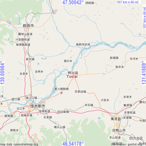
Yuelai GPS coordinates[2]
47° 1' 23.7" North, 130° 42' 46.656" East
| Map corner | latitude | longitude |
|---|---|---|
| Upper-left | 47.50042°, | 130.00984° |
| Center: | 47.02325°, | 130.71296° |
| Lower-right: | 46.54178°, | 131.41609° |
| Map W x H: | 106.6×106.6 km | = 66.2×66.2mi |
| max Lat: | 53.31946° ⇑3% North |
| Yuelai: | 47.02325° |
| min Lat: | ⇓97% South 18.22056° |
| min Long | Yuelai | max Long |
| 75.07348° | 130.71296° | 134.28917° |
| W 99.7%⇐ | ⇒0.3% E |
Elevation
Elevation of Yuelai is 77 m = 253 ft, and this is 407.8 m = 1338 ft below average elevation for this country.
| Max E: |
5622 m = 18445 ft | 64.1% |
| Avg. | 484.8 m = 1591 ft | |
| Yuelai | 77 m = 253 ft | |
Min E: |
-3 m = -10 ft | 35.9% |
See also: China elevation on elevation.city.
Geographical zone
Yuelai is located in North temperate zone (between Tropic of Cancer and the Arctic Circle). Distance of this North polar circle is 2172.7 km =1350.1 mi to North.| Distance of | km | miles | from Yuelai |
|---|---|---|---|
| North Pole | 4778.6 | 2969.3 | to North |
| Arctic Circle | 2172.7 | 1350.1 | to North |
| Tropic Cancer | 2622.6 | 1629.6 | to South |
| Equator | 5228.5 | 3248.8 | to South |


Nearby cities:
15 places around Yuelai: (largest is in red/bold)
• Chuangye
13 km =8.1 mi,  203°
203°
• Fengle
25.9 km =16.1 mi,  153°
153°
• Heli
32.9 km =20.4 mi,  276°
276°
• Jianguo
20.6 km =12.8 mi,  217°
217°
• Jianguo
33.2 km =20.6 mi,  226°
226°
• Jixiang
24.5 km =15.2 mi,  272°
272°
• Lianjiangkou
35.6 km =22.1 mi,  239°
239°
• Ping’an
34 km =21.1 mi, 241°
• Simajia
29 km =18 mi,  194°
194°
• Songjiang
30 km =18.6 mi, 225°
• Sujiadian
14.3 km =8.9 mi,  158°
158°
• Taiping
29.2 km =18.1 mi,  182°
182°
• Xinghuo
15 km =9.3 mi,  213°
213°
• Xinhua
33.1 km =20.6 mi,  287°
287°
• Zhenxing
9.6 km =6 mi,  337°
337°
Sources, notices
• [Note1] Compared only with cities in China existing in our database
• [Src1] Map data: © OpenStreetMap contributors (CC-BY-SA)
• [Src2] Other city data from geonames.org with taken over terms of usage.
• [Src3] Geographical zone / Annual Mean Temperature by Robert A. Rohde @ Wikipedia
