Yahe geodata
Yahe (Heilongjiang) is a seat of a fourth-order administrative division; located in China in Asia/Shanghai (GMT+8) time zone. In our database, there are 1268 cities with bigger population. Compared to other cities in China, 94.3% of cities are located further ↓South; 99.5% of cities are located further ←West and 63.5% of cities have lower elevation than Yahe. Note1


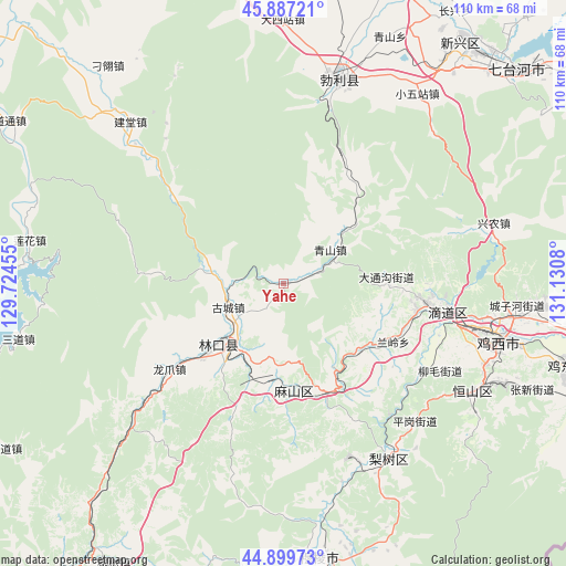
Yahe GPS coordinates[2]
45° 23' 44.268" North, 130° 25' 39.612" East
| Map corner | latitude | longitude |
|---|---|---|
| Upper-left | 45.88721°, | 129.72455° |
| Center: | 45.39563°, | 130.42767° |
| Lower-right: | 44.89973°, | 131.1308° |
| Map W x H: | 109.8×109.8 km | = 68.2×68.2mi |
| max Lat: | 53.31946° ⇑5.7% North |
| Yahe: | 45.39563° |
| min Lat: | ⇓94.3% South 18.22056° |
| min Long | Yahe | max Long |
| 75.07348° | 130.42767° | 134.28917° |
| W 99.5%⇐ | ⇒0.5% E |
Elevation
Elevation of Yahe is 304 m = 997 ft, and this is 180.8 m = 593 ft below average elevation for this country.
| Max E: |
5622 m = 18445 ft | 36.5% |
| Avg. | 484.8 m = 1591 ft | |
| Yahe | 304 m = 997 ft | |
Min E: |
-3 m = -10 ft | 63.5% |
See also: China elevation on elevation.city.
Geographical zone
Yahe is located in North temperate zone (between Tropic of Cancer and the Arctic Circle). Distance of this North polar circle is 2353.7 km =1462.5 mi to North.| Distance of | km | miles | from Yahe |
|---|---|---|---|
| North Pole | 4959.5 | 3081.7 | to North |
| Arctic Circle | 2353.7 | 1462.5 | to North |
| Tropic Cancer | 2441.6 | 1517.1 | to South |
| Equator | 5047.5 | 3136.4 | to South |


Nearby cities:
15 places around Yahe: (largest is in red/bold)
• Boli
41.3 km =25.7 mi,  15°
15°
• Didaohe
32.8 km =20.4 mi,  98°
98°
• Dongxing
28.3 km =17.6 mi, 97°
• Fendou
42.4 km =26.3 mi,  118°
118°
• Gucheng
12.1 km =7.5 mi,  246°
246°
• Jiantang
43.3 km =26.9 mi,  316°
316°
• Jixi
42.7 km =26.5 mi, 104°
• Kuishan
18.8 km =11.7 mi,  187°
187°
• Lanling
24.1 km =15 mi, 117°
• Linkou
17.8 km =11.1 mi,  226°
226°
• Lishu
39.8 km =24.7 mi,  148°
148°
• Longzhua
27.5 km =17.1 mi, 233°
• Mashan
22.5 km =14 mi,  160°
160°
• Xijiao
41.4 km =25.7 mi, 101°
• Xingnong
42.1 km =26.2 mi,  73°
73°
Sources, notices
• [Note1] Compared only with cities in China existing in our database
• [Src1] Map data: © OpenStreetMap contributors (CC-BY-SA)
• [Src2] Other city data from geonames.org with taken over terms of usage.
• [Src3] Geographical zone / Annual Mean Temperature by Robert A. Rohde @ Wikipedia
