Xingnong geodata
Xingnong (Heilongjiang) is a seat of a fourth-order administrative division; located in China in Asia/Shanghai (GMT+8) time zone. In our database, there are 1268 cities with bigger population. Compared to other cities in China, 94.4% of cities are located further ↓South; 99.9% of cities are located further ←West and 60.2% of cities have lower elevation than Xingnong. Note1


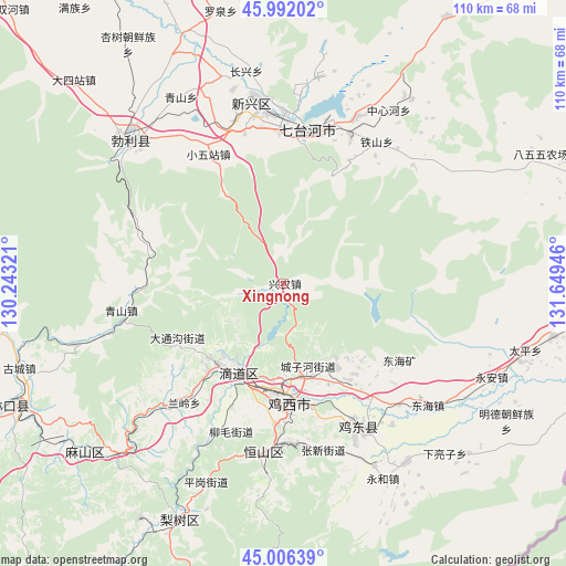
Xingnong GPS coordinates[2]
45° 30' 4.896" North, 130° 56' 46.788" East
| Map corner | latitude | longitude |
|---|---|---|
| Upper-left | 45.99202°, | 130.24321° |
| Center: | 45.50136°, | 130.94633° |
| Lower-right: | 45.00639°, | 131.64946° |
| Map W x H: | 109.6×109.6 km | = 68.1×68.1mi |
| max Lat: | 53.31946° ⇑5.6% North |
| Xingnong: | 45.50136° |
| min Lat: | ⇓94.4% South 18.22056° |
| min Long | Xingnong | max Long |
| 75.07348° | 130.94633° | 134.28917° |
| W 99.9%⇐ | ⇒0.099999999999994% E |
Elevation
Elevation of Xingnong is 261 m = 856 ft, and this is 223.8 m = 734 ft below average elevation for this country.
| Max E: |
5622 m = 18445 ft | 39.8% |
| Avg. | 484.8 m = 1591 ft | |
| Xingnong | 261 m = 856 ft | |
Min E: |
-3 m = -10 ft | 60.2% |
See also: China elevation on elevation.city.
Geographical zone
Xingnong is located in North temperate zone (between Tropic of Cancer and the Arctic Circle). Distance of this North polar circle is 2341.9 km =1455.2 mi to North.| Distance of | km | miles | from Xingnong |
|---|---|---|---|
| North Pole | 4947.8 | 3074.4 | to North |
| Arctic Circle | 2341.9 | 1455.2 | to North |
| Tropic Cancer | 2453.4 | 1524.5 | to South |
| Equator | 5059.3 | 3143.7 | to South |


Nearby cities:
15 places around Xingnong: (largest is in red/bold)
• Chengzihe
20.9 km =13 mi,  153°
153°
• Didaohe
18.6 km =11.6 mi,  205°
205°
• Dongxing
20 km =12.4 mi,  218°
218°
• Fendou
32.3 km =20.1 mi,  186°
186°
• Hongjunlu
22.1 km =13.7 mi,  173°
173°
• Hongqi
32.2 km =20 mi,  182°
182°
• Hongqi
34.8 km =21.6 mi,  350°
350°
• Hongxing
25.3 km =15.7 mi, 177°
• Jidong
33.4 km =20.8 mi,  161°
161°
• Jixi
22.3 km =13.9 mi, 177°
• Lanling
29.9 km =18.6 mi, 219°
• Taihecun
30.1 km =18.7 mi, 345°
• Wanbaohe
30.6 km =19 mi,  3°
3°
• Xiaowuzhan
28.8 km =17.9 mi,  330°
330°
• Xijiao
20.2 km =12.6 mi, 179°
Sources, notices
• [Note1] Compared only with cities in China existing in our database
• [Src1] Map data: © OpenStreetMap contributors (CC-BY-SA)
• [Src2] Other city data from geonames.org with taken over terms of usage.
• [Src3] Geographical zone / Annual Mean Temperature by Robert A. Rohde @ Wikipedia
