Longzhua geodata
Longzhua (Heilongjiang) is a seat of a fourth-order administrative division; located in China in Asia/Shanghai (GMT+8) time zone. In our database, there are 1268 cities with bigger population. Compared to other cities in China, 94.1% of cities are located further ↓South; 99.2% of cities are located further ←West and 60.8% of cities have lower elevation than Longzhua. Note1


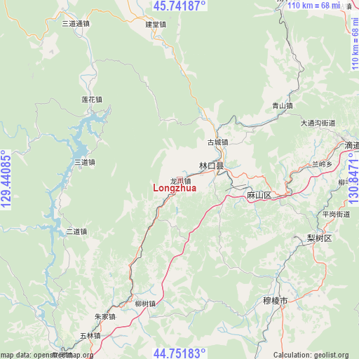
Longzhua GPS coordinates[2]
45° 14' 56.436" North, 130° 8' 38.292" East
| Map corner | latitude | longitude |
|---|---|---|
| Upper-left | 45.74187°, | 129.44085° |
| Center: | 45.24901°, | 130.14397° |
| Lower-right: | 44.75183°, | 130.8471° |
| Map W x H: | 110.1×110.1 km | = 68.4×68.4mi |
| max Lat: | 53.31946° ⇑5.9% North |
| Longzhua: | 45.24901° |
| min Lat: | ⇓94.1% South 18.22056° |
| min Long | Longzhua | max Long |
| 75.07348° | 130.14397° | 134.28917° |
| W 99.2%⇐ | ⇒0.8% E |
Elevation
Elevation of Longzhua is 268 m = 879 ft, and this is 216.8 m = 711 ft below average elevation for this country.
| Max E: |
5622 m = 18445 ft | 39.2% |
| Avg. | 484.8 m = 1591 ft | |
| Longzhua | 268 m = 879 ft | |
Min E: |
-3 m = -10 ft | 60.8% |
See also: China elevation on elevation.city.
Geographical zone
Longzhua is located in North temperate zone (between Tropic of Cancer and the Arctic Circle). Distance of this North polar circle is 2370 km =1472.6 mi to North.| Distance of | km | miles | from Longzhua |
|---|---|---|---|
| North Pole | 4975.8 | 3091.8 | to North |
| Arctic Circle | 2370 | 1472.6 | to North |
| Tropic Cancer | 2425.3 | 1507 | to South |
| Equator | 5031.2 | 3126.2 | to South |


Nearby cities:
15 places around Longzhua: (largest is in red/bold)
• Bamiantong
47.2 km =29.3 mi,  141°
141°
• Erdaohezi
35.5 km =22.1 mi,  243°
243°
• Gucheng
16 km =9.9 mi,  43°
43°
• Hexi
44.6 km =27.7 mi, 143°
• Jiantang
48.3 km =30 mi,  350°
350°
• Kuishan
19.9 km =12.4 mi,  96°
96°
• Lanling
43.9 km =27.3 mi,  83°
83°
• Lianhua
41.8 km =26 mi,  318°
318°
• Linkou
10.1 km =6.3 mi,  65°
65°
• Lishu
46.4 km =28.8 mi,  112°
112°
• Liushu
39.3 km =24.4 mi,  195°
195°
• Mashan
30.3 km =18.8 mi, 99°
• Sandaohezi
29.7 km =18.5 mi,  281°
281°
• Yahe
27.5 km =17.1 mi,  53°
53°
• Zhujia
48.1 km =29.9 mi,  209°
209°
Sources, notices
• [Note1] Compared only with cities in China existing in our database
• [Src1] Map data: © OpenStreetMap contributors (CC-BY-SA)
• [Src2] Other city data from geonames.org with taken over terms of usage.
• [Src3] Geographical zone / Annual Mean Temperature by Robert A. Rohde @ Wikipedia
