Xintian geodata
Xintian (Inner Mongolia) is a seat of a fourth-order administrative division; located in China in Asia/Shanghai (GMT+8) time zone. In our database, there are 1268 cities with bigger population. Compared to other cities in China, 99.8% of cities are located further ↓South; 94% of cities are located further ←West and 76.1% of cities have lower elevation than Xintian. Note1


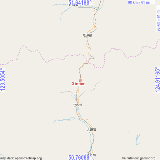
Xintian GPS coordinates[2]
51° 12' 12.744" North, 124° 12' 30.672" East
| Map corner | latitude | longitude |
|---|---|---|
| Upper-left | 51.64198°, | 123.5054° |
| Center: | 51.20354°, | 124.20852° |
| Lower-right: | 50.76088°, | 124.91165° |
| Map W x H: | 98×98 km | = 60.9×60.9mi |
| max Lat: | 53.31946° ⇑0.2% North |
| Xintian: | 51.20354° |
| min Lat: | ⇓99.8% South 18.22056° |
| min Long | Xintian | max Long |
| 75.07348° | 124.20852° | 134.28917° |
| W 94%⇐ | ⇒6% E |
Elevation
Elevation of Xintian is 549 m = 1801 ft, and this is 64.2 m = 211 ft above average elevation for this country.
| Max E: |
5622 m = 18445 ft | 23.9% |
| Xintian | 549 m 1801 ft | |
| Avg. | 484.8 m = 1591 ft | |
Min E: |
-3 m = -10 ft | 76.1% |
See also: China elevation on elevation.city.
Geographical zone
Xintian is located in North temperate zone (between Tropic of Cancer and the Arctic Circle). Distance of this North polar circle is 1707.9 km =1061.2 mi to North.| Distance of | km | miles | from Xintian |
|---|---|---|---|
| North Pole | 4313.8 | 2680.5 | to North |
| Arctic Circle | 1707.9 | 1061.2 | to North |
| Tropic Cancer | 3087.4 | 1918.4 | to South |
| Equator | 5693.3 | 3537.7 | to South |


Nearby cities:
15 places around Xintian: (largest is in red/bold)
• Bizhou
86.5 km =53.7 mi,  18°
18°
• Cangshan
77.7 km =48.3 mi,  326°
326°
• Dawusu
69.7 km =43.3 mi, 17°
• Dayangqi
24.3 km =15.1 mi,  201°
201°
• Guyuan
30.5 km =19 mi,  166°
166°
• Hongtu
46.9 km =29.1 mi,  354°
354°
• Hongwei
94.2 km =58.5 mi,  335°
335°
• Huyuan
75.5 km =46.9 mi,  323°
323°
• Jiagedaqi
87.7 km =54.5 mi,  184°
184°
• Jinsong
14.8 km =9.2 mi,  185°
185°
• Linhai
44.9 km =27.9 mi,  12°
12°
• Oroqen Zizhiqi
78.8 km =49 mi,  205°
205°
• Tayuan
27.8 km =17.3 mi, 8°
• Xiaoyangqi
45.2 km =28.1 mi, 173°
• Xinlin
55.9 km =34.7 mi, 8°
Sources, notices
• [Note1] Compared only with cities in China existing in our database
• [Src1] Map data: © OpenStreetMap contributors (CC-BY-SA)
• [Src2] Other city data from geonames.org with taken over terms of usage.
• [Src3] Geographical zone / Annual Mean Temperature by Robert A. Rohde @ Wikipedia
