Dayangqi geodata
Dayangqi (Inner Mongolia) is a seat of a fourth-order administrative division; located in China in Asia/Shanghai (GMT+8) time zone. In our database, there are 1268 cities with bigger population. Compared to other cities in China, 99.8% of cities are located further ↓South; 93.9% of cities are located further ←West and 73.4% of cities have lower elevation than Dayangqi. Note1


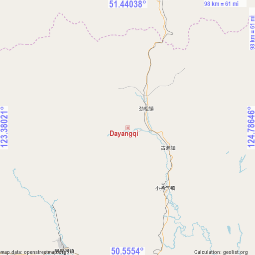
Dayangqi GPS coordinates[2]
51° 0' 0" North, 124° 4' 59.988" East
| Map corner | latitude | longitude |
|---|---|---|
| Upper-left | 51.44038°, | 123.38021° |
| Center: | 51°, | 124.08333° |
| Lower-right: | 50.5554°, | 124.78646° |
| Map W x H: | 98.4×98.4 km | = 61.1×61.1mi |
| max Lat: | 53.31946° ⇑0.2% North |
| Dayangqi: | 51° |
| min Lat: | ⇓99.8% South 18.22056° |
| min Long | Dayangqi | max Long |
| 75.07348° | 124.08333° | 134.28917° |
| W 93.9%⇐ | ⇒6.1% E |
Elevation
Elevation of Dayangqi is 483 m = 1585 ft, and this is 1.8 m = 6 ft below average elevation for this country.
| Max E: |
5622 m = 18445 ft | 26.6% |
| Avg. | 484.8 m = 1591 ft | |
| Dayangqi | 483 m = 1585 ft | |
Min E: |
-3 m = -10 ft | 73.4% |
See also: China elevation on elevation.city.
Geographical zone
Dayangqi is located in North temperate zone (between Tropic of Cancer and the Arctic Circle). Distance of this North polar circle is 1730.5 km =1075.3 mi to North.| Distance of | km | miles | from Dayangqi |
|---|---|---|---|
| North Pole | 4336.4 | 2694.5 | to North |
| Arctic Circle | 1730.5 | 1075.3 | to North |
| Tropic Cancer | 3064.7 | 1904.3 | to South |
| Equator | 5670.7 | 3523.6 | to South |


Nearby cities:
15 places around Dayangqi: (largest is in red/bold)
• Cangshan
94 km =58.4 mi,  338°
338°
• Dawusu
93.9 km =58.3 mi,  18°
18°
• Ganhe
79.3 km =49.3 mi,  240°
240°
• Guyuan
17.4 km =10.8 mi,  113°
113°
• Hongtu
69.5 km =43.2 mi,  3°
3°
• Huyuan
91 km =56.5 mi, 336°
• Jiagedaqi
64.9 km =40.3 mi,  177°
177°
• Jinsong
10.8 km =6.7 mi,  42°
42°
• Jiwen
78.9 km =49 mi,  233°
233°
• Linhai
69 km =42.9 mi, 15°
• Oroqen Zizhiqi
54.6 km =33.9 mi,  208°
208°
• Tayuan
51.8 km =32.2 mi,  14°
14°
• Xiaoyangqi
26.3 km =16.3 mi,  147°
147°
• Xinlin
79.7 km =49.5 mi, 12°
• Xintian
24.3 km =15.1 mi, 21°
Sources, notices
• [Note1] Compared only with cities in China existing in our database
• [Src1] Map data: © OpenStreetMap contributors (CC-BY-SA)
• [Src2] Other city data from geonames.org with taken over terms of usage.
• [Src3] Geographical zone / Annual Mean Temperature by Robert A. Rohde @ Wikipedia
