Jiagedaqi geodata
Jiagedaqi (Inner Mongolia) is a populated place; located in China in Asia/Shanghai (GMT+8) time zone. With population of 135,760 people, there are 325 cities with bigger population in this country. Compared to other cities in China, 99.7% of cities are located further ↓South; 93.9% of cities are located further ←West and 68.3% of cities have lower elevation than Jiagedaqi. Note1


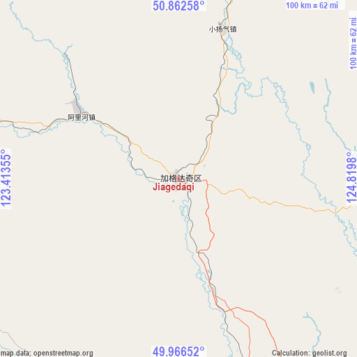
Jiagedaqi GPS coordinates[2]
50° 25' 0.012" North, 124° 7' 0.012" East
| Map corner | latitude | longitude |
|---|---|---|
| Upper-left | 50.86258°, | 123.41355° |
| Center: | 50.41667°, | 124.11667° |
| Lower-right: | 49.96652°, | 124.8198° |
| Map W x H: | 99.6×99.6 km | = 61.9×61.9mi |
| max Lat: | 53.31946° ⇑0.3% North |
| Jiagedaqi: | 50.41667° |
| min Lat: | ⇓99.7% South 18.22056° |
| min Long | Jiagedaqi | max Long |
| 75.07348° | 124.11667° | 134.28917° |
| W 93.9%⇐ | ⇒6.1% E |
Elevation
Elevation of Jiagedaqi is 381 m = 1250 ft, and this is 103.8 m = 341 ft below average elevation for this country.
| Max E: |
5622 m = 18445 ft | 31.7% |
| Avg. | 484.8 m = 1591 ft | |
| Jiagedaqi | 381 m = 1250 ft | |
Min E: |
-3 m = -10 ft | 68.3% |
See also: Jiagedaqi elevation on elevation.city.
Geographical zone
Jiagedaqi is located in North temperate zone (between Tropic of Cancer and the Arctic Circle). Distance of this North polar circle is 1795.4 km =1115.6 mi to North.| Distance of | km | miles | from Jiagedaqi |
|---|---|---|---|
| North Pole | 4401.3 | 2734.8 | to North |
| Arctic Circle | 1795.4 | 1115.6 | to North |
| Tropic Cancer | 2999.9 | 1864.1 | to South |
| Equator | 5605.8 | 3483.3 | to South |


Nearby cities:
15 places around Jiagedaqi: (largest is in red/bold)
• Dayangqi
64.9 km =40.3 mi,  357°
357°
• Dayangshu
80.8 km =50.2 mi,  156°
156°
• Ganhe
76.4 km =47.5 mi,  289°
289°
• Guli
68.6 km =42.6 mi,  124°
124°
• Guyuan
59.5 km =37 mi,  13°
13°
• Jinsong
73 km =45.4 mi,  3°
3°
• Jiwen
68.1 km =42.3 mi,  284°
284°
• Kuleqi
88.9 km =55.2 mi, 159°
• Oroqen Zizhiqi
32.8 km =20.4 mi,  300°
300°
• Oukenhe
85 km =52.8 mi,  144°
144°
• Tuozaminnutuke
77.5 km =48.2 mi,  248°
248°
• Wulu Butie
60.5 km =37.6 mi, 164°
• Xiaoyangqi
44.2 km =27.5 mi,  15°
15°
• Xintian
87.7 km =54.5 mi, 4°
• Yili
95.4 km =59.3 mi,  176°
176°
Sources, notices
• [Note1] Compared only with cities in China existing in our database
• [Src1] Map data: © OpenStreetMap contributors (CC-BY-SA)
• [Src2] Other city data from geonames.org with taken over terms of usage.
• [Src3] Geographical zone / Annual Mean Temperature by Robert A. Rohde @ Wikipedia
