Xiachengzi geodata
Xiachengzi (Heilongjiang) is a seat of a fourth-order administrative division; located in China in Asia/Shanghai (GMT+8) time zone. In our database, there are 1268 cities with bigger population. Compared to other cities in China, 93.7% of cities are located further ↓South; 99.5% of cities are located further ←West and 62.9% of cities have lower elevation than Xiachengzi. Note1


Xiachengzi GPS coordinates[2]
44° 41' 10.5" North, 130° 27' 3.78" East
| Map corner | latitude | longitude |
|---|---|---|
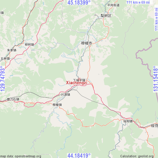
| Upper-left | 45.18399°, | 129.74793° |
| Center: | 44.68625°, | 130.45105° |
| Lower-right: | 44.18419°, | 131.15418° |
| Map W x H: | 111.2×111.2 km | = 69.1×69.1mi |
| max Lat: | 53.31946° ⇑6.3% North |
| Xiachengzi: | 44.68625° |
| min Lat: | ⇓93.7% South 18.22056° |
| min Long | Xiachengzi | max Long |
| 75.07348° | 130.45105° | 134.28917° |
| W 99.5%⇐ | ⇒0.5% E |
Elevation
Elevation of Xiachengzi is 295 m = 968 ft, and this is 189.8 m = 623 ft below average elevation for this country.
| Max E: |
5622 m = 18445 ft | 37.1% |
| Avg. | 484.8 m = 1591 ft | |
| Xiachengzi | 295 m = 968 ft | |
Min E: |
-3 m = -10 ft | 62.9% |
See also: China elevation on elevation.city.
Geographical zone
Xiachengzi is located in North temperate zone (between Tropic of Cancer and the Arctic Circle). Distance of this Northern Tropic circle is 2362.7 km =1468.1 mi to South.| Distance of | km | miles | from Xiachengzi |
|---|---|---|---|
| North Pole | 5038.4 | 3130.7 | to North |
| Arctic Circle | 2432.5 | 1511.5 | to North |
| Tropic Cancer | 2362.7 | 1468.1 | to South |
| Equator | 4968.6 | 3087.3 | to South |


Nearby cities:
15 places around Xiachengzi: (largest is in red/bold)
• Bamiantong
26.3 km =16.3 mi,  11°
11°
• Fulu
29.6 km =18.4 mi,  20°
20°
• Hexi
26.9 km =16.7 mi, 5°
• Hualin
61.3 km =38.1 mi,  269°
269°
• Kuishan
60.4 km =37.5 mi,  355°
355°
• Lishu
48.7 km =30.3 mi, 22°
• Liushu
42.9 km =26.7 mi,  305°
305°
• Maqiaohe
6.7 km =4.2 mi,  85°
85°
• Mashan
58 km =36 mi, 5°
• Modaoshi
48.9 km =30.4 mi,  253°
253°
• Muleng
24.3 km =15.1 mi,  220°
220°
• Suiyang
45 km =28 mi,  130°
130°
• Wulin
54.1 km =33.6 mi,  285°
285°
• Xingyuan
14.3 km =8.9 mi, 223°
• Zhujia
51.9 km =32.2 mi, 293°
Sources, notices
• [Note1] Compared only with cities in China existing in our database
• [Src1] Map data: © OpenStreetMap contributors (CC-BY-SA)
• [Src2] Other city data from geonames.org with taken over terms of usage.
• [Src3] Geographical zone / Annual Mean Temperature by Robert A. Rohde @ Wikipedia
