Fulu geodata
Fulu (Heilongjiang) is a seat of a fourth-order administrative division; located in China in Asia/Shanghai (GMT+8) time zone. In our database, there are 1268 cities with bigger population. Compared to other cities in China, 93.8% of cities are located further ↓South; 99.6% of cities are located further ←West and 61.5% of cities have lower elevation than Fulu. Note1


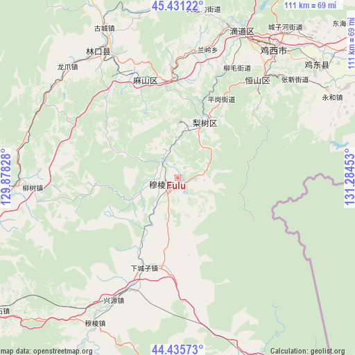
Fulu GPS coordinates[2]
44° 56' 8.268" North, 130° 34' 53.04" East
| Map corner | latitude | longitude |
|---|---|---|
| Upper-left | 45.43122°, | 129.87828° |
| Center: | 44.93563°, | 130.5814° |
| Lower-right: | 44.43573°, | 131.28453° |
| Map W x H: | 110.7×110.7 km | = 68.8×68.8mi |
| max Lat: | 53.31946° ⇑6.2% North |
| Fulu: | 44.93563° |
| min Lat: | ⇓93.8% South 18.22056° |
| min Long | Fulu | max Long |
| 75.07348° | 130.5814° | 134.28917° |
| W 99.6%⇐ | ⇒0.40000000000001% E |
Elevation
Elevation of Fulu is 277 m = 909 ft, and this is 207.8 m = 682 ft below average elevation for this country.
| Max E: |
5622 m = 18445 ft | 38.5% |
| Avg. | 484.8 m = 1591 ft | |
| Fulu | 277 m = 909 ft | |
Min E: |
-3 m = -10 ft | 61.5% |
See also: China elevation on elevation.city.
Geographical zone
Fulu is located in North temperate zone (between Tropic of Cancer and the Arctic Circle). Distance of this Northern Tropic circle is 2390.5 km =1485.4 mi to South.| Distance of | km | miles | from Fulu |
|---|---|---|---|
| North Pole | 5010.7 | 3113.5 | to North |
| Arctic Circle | 2404.8 | 1494.3 | to North |
| Tropic Cancer | 2390.5 | 1485.4 | to South |
| Equator | 4996.4 | 3104.6 | to South |


Nearby cities:
15 places around Fulu: (largest is in red/bold)
• Bamiantong
5.2 km =3.2 mi,  247°
247°
• Fendou
39.8 km =24.7 mi,  39°
39°
• Hexi
7.8 km =4.8 mi,  262°
262°
• Hongqi
40.9 km =25.4 mi, 41°
• Hongxing
48 km =29.8 mi, 38°
• Kuishan
35.6 km =22.1 mi,  335°
335°
• Lanling
41 km =25.5 mi,  13°
13°
• Linkou
46.3 km =28.8 mi,  327°
327°
• Lishu
19.2 km =11.9 mi,  26°
26°
• Liushu
45.3 km =28.1 mi,  266°
266°
• Longzhua
48.9 km =30.4 mi,  315°
315°
• Maqiaohe
27.4 km =17 mi,  187°
187°
• Mashan
30.3 km =18.8 mi,  351°
351°
• Xiachengzi
29.6 km =18.4 mi,  200°
200°
• Xingyuan
43.1 km =26.8 mi,  207°
207°
Sources, notices
• [Note1] Compared only with cities in China existing in our database
• [Src1] Map data: © OpenStreetMap contributors (CC-BY-SA)
• [Src2] Other city data from geonames.org with taken over terms of usage.
• [Src3] Geographical zone / Annual Mean Temperature by Robert A. Rohde @ Wikipedia
