Suiyang geodata
Suiyang (Heilongjiang) is a seat of a fourth-order administrative division; located in China in Asia/Shanghai (GMT+8) time zone. In our database, there are 1268 cities with bigger population. Compared to other cities in China, 93.3% of cities are located further ↓South; 99.8% of cities are located further ←West and 64% of cities have lower elevation than Suiyang. Note1


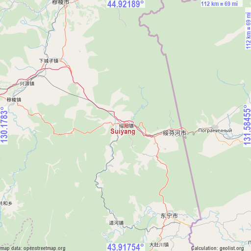
Suiyang GPS coordinates[2]
44° 25' 18.732" North, 130° 52' 53.112" East
| Map corner | latitude | longitude |
|---|---|---|
| Upper-left | 44.92189°, | 130.1783° |
| Center: | 44.42187°, | 130.88142° |
| Lower-right: | 43.91754°, | 131.58455° |
| Map W x H: | 111.7×111.7 km | = 69.4×69.4mi |
| max Lat: | 53.31946° ⇑6.7% North |
| Suiyang: | 44.42187° |
| min Lat: | ⇓93.3% South 18.22056° |
| min Long | Suiyang | max Long |
| 75.07348° | 130.88142° | 134.28917° |
| W 99.8%⇐ | ⇒0.2% E |
Elevation
Elevation of Suiyang is 310 m = 1017 ft, and this is 174.8 m = 573 ft below average elevation for this country.
| Max E: |
5622 m = 18445 ft | 36% |
| Avg. | 484.8 m = 1591 ft | |
| Suiyang | 310 m = 1017 ft | |
Min E: |
-3 m = -10 ft | 64% |
See also: China elevation on elevation.city.
Geographical zone
Suiyang is located in North temperate zone (between Tropic of Cancer and the Arctic Circle). Distance of this Northern Tropic circle is 2333.3 km =1449.8 mi to South.| Distance of | km | miles | from Suiyang |
|---|---|---|---|
| North Pole | 5067.8 | 3149 | to North |
| Arctic Circle | 2461.9 | 1529.8 | to North |
| Tropic Cancer | 2333.3 | 1449.8 | to South |
| Equator | 4939.2 | 3069.1 | to South |


Nearby cities:
15 places around Suiyang: (largest is in red/bold)
• Bamiantong
62.1 km =38.6 mi,  332°
332°
• Daduchuan
55 km =34.2 mi,  164°
164°
• Daohe
43.4 km =27 mi,  185°
185°
• Dongning
44.3 km =27.5 mi,  154°
154°
• Fulu
61.9 km =38.5 mi,  337°
337°
• Gonghe
64 km =39.8 mi,  237°
237°
• Hexi
64.4 km =40 mi, 330°
• Laoheishan
79 km =49.1 mi,  180°
180°
• Lishu
75.8 km =47.1 mi,  348°
348°
• Maqiaohe
40.6 km =25.2 mi,  317°
317°
• Muleng
51.2 km =31.8 mi,  282°
282°
• Sanchakou Chaoxianzu
53.2 km =33.1 mi, 147°
• Suifenhe
21.3 km =13.2 mi,  96°
96°
• Xiachengzi
45 km =28 mi,  310°
310°
• Xingyuan
47.9 km =29.8 mi,  293°
293°
Sources, notices
• [Note1] Compared only with cities in China existing in our database
• [Src1] Map data: © OpenStreetMap contributors (CC-BY-SA)
• [Src2] Other city data from geonames.org with taken over terms of usage.
• [Src3] Geographical zone / Annual Mean Temperature by Robert A. Rohde @ Wikipedia
