Uliastai geodata
Uliastai (Inner Mongolia) is a seat of a third-order administrative division; located in China in Asia/Shanghai (GMT+8) time zone. In our database, there are 1268 cities with bigger population. Compared to other cities in China, 94.4% of cities are located further ↓South; 65.1% of cities are located further ←West and 83.3% of cities have lower elevation than Uliastai. Note1


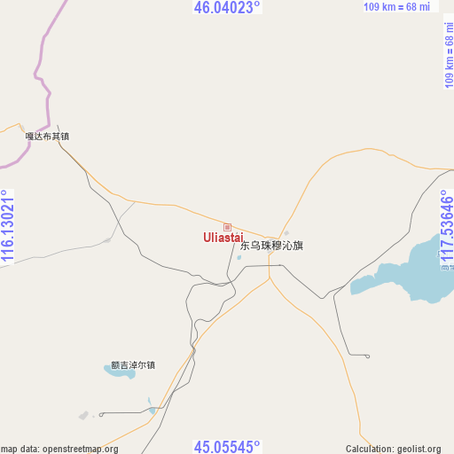
Uliastai GPS coordinates[2]
45° 33' 0" North, 116° 49' 59.988" East
| Map corner | latitude | longitude |
|---|---|---|
| Upper-left | 46.04023°, | 116.13021° |
| Center: | 45.55°, | 116.83333° |
| Lower-right: | 45.05545°, | 117.53646° |
| Map W x H: | 109.5×109.5 km | = 68×68mi |
| max Lat: | 53.31946° ⇑5.6% North |
| Uliastai: | 45.55° |
| min Lat: | ⇓94.4% South 18.22056° |
| min Long | Uliastai | max Long |
| 75.07348° | 116.83333° | 134.28917° |
| W 65.1%⇐ | ⇒34.9% E |
Elevation
Elevation of Uliastai is 868 m = 2848 ft, and this is 383.2 m = 1257 ft above average elevation for this country.
| Max E: |
5622 m = 18445 ft | 16.7% |
| Uliastai | 868 m 2848 ft | |
| Avg. | 484.8 m = 1591 ft | |
Min E: |
-3 m = -10 ft | 83.3% |
See also: China elevation on elevation.city.
Geographical zone
Uliastai is located in North temperate zone (between Tropic of Cancer and the Arctic Circle). Distance of this North polar circle is 2336.5 km =1451.8 mi to North.| Distance of | km | miles | from Uliastai |
|---|---|---|---|
| North Pole | 4942.4 | 3071.1 | to North |
| Arctic Circle | 2336.5 | 1451.8 | to North |
| Tropic Cancer | 2458.8 | 1527.8 | to South |
| Equator | 5064.7 | 3147.1 | to South |


Nearby cities:
15 places around Uliastai: (largest is in red/bold)
• Altan Hil
111.2 km =69.1 mi,  249°
249°
• Bala Ga’er Gaole
123.3 km =76.6 mi,  149°
149°
• Bayan Bulag
162.1 km =100.7 mi,  205°
205°
• Bayan Huxu
89.9 km =55.9 mi, 145°
• Bayan Tug
184.9 km =114.9 mi, 247°
• Bieligutai
223.4 km =138.8 mi,  220°
220°
• Burgastai
173.8 km =108 mi,  105°
105°
• Eren Gobi
133.6 km =83 mi,  58°
58°
• Holt
223.7 km =139 mi,  123°
123°
• Jirin Gol
121.8 km =75.7 mi,  171°
171°
• Mositai
220.7 km =137.1 mi,  90°
90°
• Naran Bulag
236.3 km =146.8 mi,  244°
244°
• Subrag
197.7 km =122.8 mi,  139°
139°
• Xilin Hot
187 km =116.2 mi,  199°
199°
• Xiritala
189 km =117.4 mi, 198°
Sources, notices
• [Note1] Compared only with cities in China existing in our database
• [Src1] Map data: © OpenStreetMap contributors (CC-BY-SA)
• [Src2] Other city data from geonames.org with taken over terms of usage.
• [Src3] Geographical zone / Annual Mean Temperature by Robert A. Rohde @ Wikipedia
