Holt geodata
Holt (Inner Mongolia) is a seat of a fourth-order administrative division; located in China in Asia/Shanghai (GMT+8) time zone. In our database, there are 1268 cities with bigger population. Compared to other cities in China, 93.4% of cities are located further ↓South; 77% of cities are located further ←West and 87.7% of cities have lower elevation than Holt. Note1


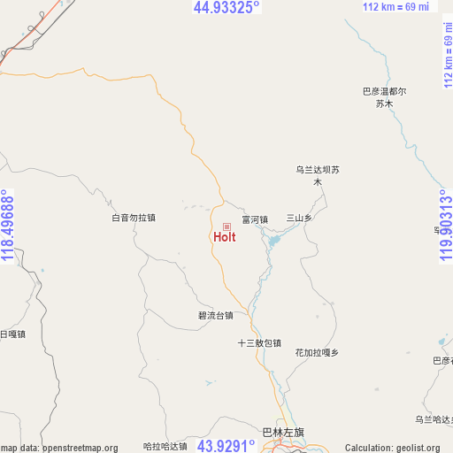
Holt GPS coordinates[2]
44° 25' 59.988" North, 119° 12' 0" East
| Map corner | latitude | longitude |
|---|---|---|
| Upper-left | 44.93325°, | 118.49688° |
| Center: | 44.43333°, | 119.2° |
| Lower-right: | 43.9291°, | 119.90313° |
| Map W x H: | 111.7×111.7 km | = 69.4×69.4mi |
| max Lat: | 53.31946° ⇑6.6% North |
| Holt: | 44.43333° |
| min Lat: | ⇓93.4% South 18.22056° |
| min Long | Holt | max Long |
| 75.07348° | 119.2° | 134.28917° |
| W 77%⇐ | ⇒23% E |
Elevation
Elevation of Holt is 1166 m = 3825 ft, and this is 681.2 m = 2235 ft above average elevation for this country.
| Max E: |
5622 m = 18445 ft | 12.3% |
| Holt | 1166 m 3825 ft | |
| Avg. | 484.8 m = 1591 ft | |
Min E: |
-3 m = -10 ft | 87.7% |
See also: China elevation on elevation.city.
Geographical zone
Holt is located in North temperate zone (between Tropic of Cancer and the Arctic Circle). Distance of this Northern Tropic circle is 2334.6 km =1450.7 mi to South.| Distance of | km | miles | from Holt |
|---|---|---|---|
| North Pole | 5066.5 | 3148.2 | to North |
| Arctic Circle | 2460.7 | 1529 | to North |
| Tropic Cancer | 2334.6 | 1450.7 | to South |
| Equator | 4940.5 | 3069.9 | to South |


Nearby cities:
15 places around Holt: (largest is in red/bold)
• Bala Ga’er Gaole
126.2 km =78.4 mi,  278°
278°
• Bayan Huxu
144.7 km =89.9 mi,  290°
290°
• Bayan Tal
99.3 km =61.7 mi,  92°
92°
• Bayart Huxu
117.2 km =72.8 mi,  50°
50°
• Burgastai
78.9 km =49 mi,  346°
346°
• Daban
108.8 km =67.6 mi,  203°
203°
• Har Nur
150.8 km =93.7 mi,  27°
27°
• Jirin Gol
169.4 km =105.3 mi,  271°
271°
• Lindong
50.1 km =31.1 mi,  181°
181°
• Linxi
138.2 km =85.9 mi,  222°
222°
• Lubei
140.5 km =87.3 mi,  82°
82°
• Mositai
127.9 km =79.5 mi,  16°
16°
• Subrag
63.8 km =39.6 mi,  246°
246°
• Tianshan
93.6 km =58.2 mi,  130°
130°
• Wudan
167.3 km =104 mi, 184°
Sources, notices
• [Note1] Compared only with cities in China existing in our database
• [Src1] Map data: © OpenStreetMap contributors (CC-BY-SA)
• [Src2] Other city data from geonames.org with taken over terms of usage.
• [Src3] Geographical zone / Annual Mean Temperature by Robert A. Rohde @ Wikipedia
