Tulihe geodata
Tulihe (Inner Mongolia) is a seat of a fourth-order administrative division; located in China in Asia/Shanghai (GMT+8) time zone. In our database, there are 1268 cities with bigger population. Compared to other cities in China, 99.7% of cities are located further ↓South; 90.5% of cities are located further ←West and 80.8% of cities have lower elevation than Tulihe. Note1


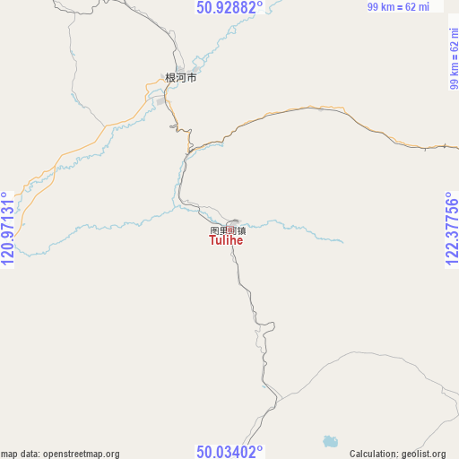
Tulihe GPS coordinates[2]
50° 29' 0.744" North, 121° 40' 27.948" East
| Map corner | latitude | longitude |
|---|---|---|
| Upper-left | 50.92882°, | 120.97131° |
| Center: | 50.48354°, | 121.67443° |
| Lower-right: | 50.03402°, | 122.37756° |
| Map W x H: | 99.5×99.5 km | = 61.8×61.8mi |
| max Lat: | 53.31946° ⇑0.3% North |
| Tulihe: | 50.48354° |
| min Lat: | ⇓99.7% South 18.22056° |
| min Long | Tulihe | max Long |
| 75.07348° | 121.67443° | 134.28917° |
| W 90.5%⇐ | ⇒9.5% E |
Elevation
Elevation of Tulihe is 733 m = 2405 ft, and this is 248.2 m = 814 ft above average elevation for this country.
| Max E: |
5622 m = 18445 ft | 19.2% |
| Tulihe | 733 m 2405 ft | |
| Avg. | 484.8 m = 1591 ft | |
Min E: |
-3 m = -10 ft | 80.8% |
See also: China elevation on elevation.city.
Geographical zone
Tulihe is located in North temperate zone (between Tropic of Cancer and the Arctic Circle). Distance of this North polar circle is 1787.9 km =1110.9 mi to North.| Distance of | km | miles | from Tulihe |
|---|---|---|---|
| North Pole | 4393.8 | 2730.2 | to North |
| Arctic Circle | 1787.9 | 1110.9 | to North |
| Tropic Cancer | 3007.3 | 1868.6 | to South |
| Equator | 5613.2 | 3487.9 | to South |


Nearby cities:
15 places around Tulihe: (largest is in red/bold)
• Derbur
71.2 km =44.2 mi,  322°
322°
• Ganhe
102.4 km =63.6 mi,  79°
79°
• Genhe
35.1 km =21.8 mi,  341°
341°
• Haolibao
31.5 km =19.6 mi,  332°
332°
• Jinhe
95.8 km =59.5 mi,  352°
352°
• Jiwen
107.3 km =66.7 mi, 84°
• Keyihe
60.6 km =37.7 mi,  73°
73°
• Kudu’er
50.7 km =31.5 mi,  184°
184°
• Mo’er Daoga
107 km =66.5 mi, 323°
• Shangkuli
89.6 km =55.7 mi,  253°
253°
• Tuozaminnutuke
107.6 km =66.9 mi,  109°
109°
• Wu’erqihan
102.7 km =63.8 mi,  191°
191°
• Xiniqi
11.1 km =6.9 mi,  171°
171°
• Yitulihe
18.5 km =11.5 mi, 335°
• Yuanlin
69.6 km =43.2 mi,  197°
197°
Sources, notices
• [Note1] Compared only with cities in China existing in our database
• [Src1] Map data: © OpenStreetMap contributors (CC-BY-SA)
• [Src2] Other city data from geonames.org with taken over terms of usage.
• [Src3] Geographical zone / Annual Mean Temperature by Robert A. Rohde @ Wikipedia
