Ganhe geodata
Ganhe (Inner Mongolia) is a seat of a fourth-order administrative division; located in China in Asia/Shanghai (GMT+8) time zone. In our database, there are 1268 cities with bigger population. Compared to other cities in China, 99.7% of cities are located further ↓South; 92.7% of cities are located further ←West and 74.5% of cities have lower elevation than Ganhe. Note1


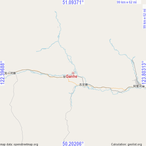
Ganhe GPS coordinates[2]
50° 39' 0" North, 123° 6' 0" East
| Map corner | latitude | longitude |
|---|---|---|
| Upper-left | 51.09371°, | 122.39688° |
| Center: | 50.65°, | 123.1° |
| Lower-right: | 50.20206°, | 123.80313° |
| Map W x H: | 99.1×99.1 km | = 61.6×61.6mi |
| max Lat: | 53.31946° ⇑0.3% North |
| Ganhe: | 50.65° |
| min Lat: | ⇓99.7% South 18.22056° |
| min Long | Ganhe | max Long |
| 75.07348° | 123.1° | 134.28917° |
| W 92.7%⇐ | ⇒7.3% E |
Elevation
Elevation of Ganhe is 512 m = 1680 ft, and this is 27.2 m = 89 ft above average elevation for this country.
| Max E: |
5622 m = 18445 ft | 25.5% |
| Ganhe | 512 m 1680 ft | |
| Avg. | 484.8 m = 1591 ft | |
Min E: |
-3 m = -10 ft | 74.5% |
See also: China elevation on elevation.city.
Geographical zone
Ganhe is located in North temperate zone (between Tropic of Cancer and the Arctic Circle). Distance of this North polar circle is 1769.4 km =1099.5 mi to North.| Distance of | km | miles | from Ganhe |
|---|---|---|---|
| North Pole | 4375.3 | 2718.7 | to North |
| Arctic Circle | 1769.4 | 1099.5 | to North |
| Tropic Cancer | 3025.8 | 1880.1 | to South |
| Equator | 5631.8 | 3499.4 | to South |


Nearby cities:
15 places around Ganhe: (largest is in red/bold)
• Dayangqi
79.3 km =49.3 mi,  60°
60°
• Genhe
112.4 km =69.8 mi,  277°
277°
• Guyuan
90.9 km =56.5 mi,  69°
69°
• Haolibao
115.2 km =71.6 mi,  274°
274°
• Jiagedaqi
76.4 km =47.5 mi,  109°
109°
• Jinsong
89.6 km =55.7 mi, 58°
• Jiwen
10.4 km =6.5 mi,  144°
144°
• Keyihe
42.5 km =26.4 mi, 268°
• Oroqen Zizhiqi
44.5 km =27.7 mi,  102°
102°
• Tulihe
102.4 km =63.6 mi,  259°
259°
• Tuozaminnutuke
54.5 km =33.9 mi,  179°
179°
• Xiaoyangqi
84.9 km =52.8 mi,  78°
78°
• Xiniqi
103.4 km =64.2 mi,  253°
253°
• Xintian
99.1 km =61.6 mi,  51°
51°
• Yitulihe
108.1 km =67.2 mi, 269°
Sources, notices
• [Note1] Compared only with cities in China existing in our database
• [Src1] Map data: © OpenStreetMap contributors (CC-BY-SA)
• [Src2] Other city data from geonames.org with taken over terms of usage.
• [Src3] Geographical zone / Annual Mean Temperature by Robert A. Rohde @ Wikipedia
