Genhe geodata
Genhe (Inner Mongolia) is a seat of a third-order administrative division; located in China in Asia/Shanghai (GMT+8) time zone. With population of 73,631 people, there are 582 cities with bigger population in this country. Compared to other cities in China, 99.8% of cities are located further ↓South; 90.1% of cities are located further ←West and 80.4% of cities have lower elevation than Genhe. Note1


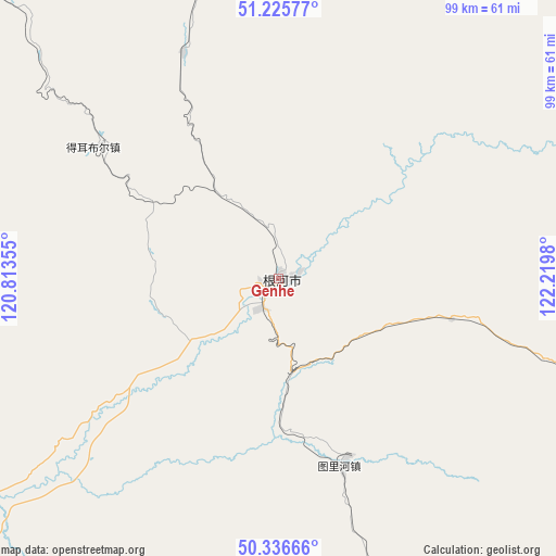
Genhe GPS coordinates[2]
50° 46' 59.988" North, 121° 31' 0.012" East
| Map corner | latitude | longitude |
|---|---|---|
| Upper-left | 51.22577°, | 120.81355° |
| Center: | 50.78333°, | 121.51667° |
| Lower-right: | 50.33666°, | 122.2198° |
| Map W x H: | 98.9×98.9 km | = 61.5×61.5mi |
| max Lat: | 53.31946° ⇑0.2% North |
| Genhe: | 50.78333° |
| min Lat: | ⇓99.8% South 18.22056° |
| min Long | Genhe | max Long |
| 75.07348° | 121.51667° | 134.28917° |
| W 90.1%⇐ | ⇒9.9% E |
Elevation
Elevation of Genhe is 713 m = 2339 ft, and this is 228.2 m = 749 ft above average elevation for this country.
| Max E: |
5622 m = 18445 ft | 19.6% |
| Genhe | 713 m 2339 ft | |
| Avg. | 484.8 m = 1591 ft | |
Min E: |
-3 m = -10 ft | 80.4% |
See also: Genhe elevation on elevation.city.
Geographical zone
Genhe is located in North temperate zone (between Tropic of Cancer and the Arctic Circle). Distance of this North polar circle is 1754.6 km =1090.3 mi to North.| Distance of | km | miles | from Genhe |
|---|---|---|---|
| North Pole | 4360.5 | 2709.5 | to North |
| Arctic Circle | 1754.6 | 1090.3 | to North |
| Tropic Cancer | 3040.7 | 1889.4 | to South |
| Equator | 5646.6 | 3508.6 | to South |


Nearby cities:
15 places around Genhe: (largest is in red/bold)
• Alongshan
104.6 km =65 mi,  13°
13°
• Derbur
39.6 km =24.6 mi,  305°
305°
• Ganhe
112.4 km =69.8 mi,  97°
97°
• Haolibao
6.3 km =3.9 mi,  211°
211°
• Jinhe
61.7 km =38.3 mi,  358°
358°
• Keyihe
70.9 km =44.1 mi, 103°
• Kudu’er
84.1 km =52.3 mi,  175°
175°
• Mo’er Daoga
74.3 km =46.2 mi,  315°
315°
• Niu’erhe
87.5 km =54.4 mi, 10°
• Sanhe
106.3 km =66.1 mi,  249°
249°
• Shangkuli
94.8 km =58.9 mi,  231°
231°
• Tulihe
35.1 km =21.8 mi,  161°
161°
• Xiniqi
46.1 km =28.6 mi, 163°
• Yitulihe
16.9 km =10.5 mi,  167°
167°
• Yuanlin
100.3 km =62.3 mi,  185°
185°
Sources, notices
• [Note1] Compared only with cities in China existing in our database
• [Src1] Map data: © OpenStreetMap contributors (CC-BY-SA)
• [Src2] Other city data from geonames.org with taken over terms of usage.
• [Src3] Geographical zone / Annual Mean Temperature by Robert A. Rohde @ Wikipedia
