Togrog Ul geodata
Togrog Ul (Inner Mongolia) is a seat of a third-order administrative division; located in China in Asia/Shanghai (GMT+8) time zone. In our database, there are 1268 cities with bigger population. Compared to other cities in China, 88.7% of cities are located further ↓South; 56.3% of cities are located further →East and 89.6% of cities have lower elevation than Togrog Ul. Note1


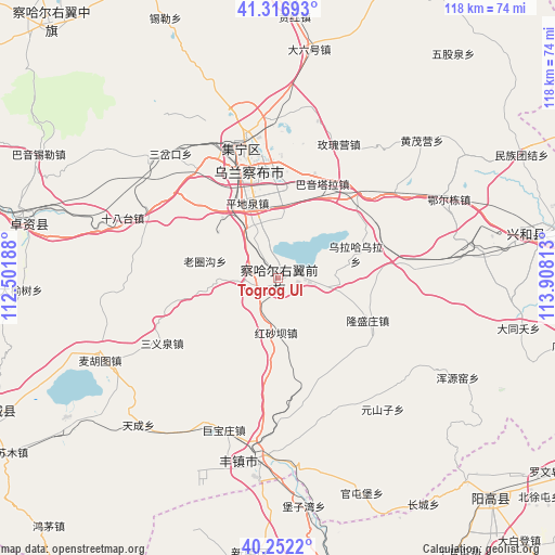
Togrog Ul GPS coordinates[2]
40° 47' 12.12" North, 113° 12' 18" East
| Map corner | latitude | longitude |
|---|---|---|
| Upper-left | 41.31693°, | 112.50188° |
| Center: | 40.7867°, | 113.205° |
| Lower-right: | 40.2522°, | 113.90813° |
| Map W x H: | 118.4×118.4 km | = 73.6×73.6mi |
| max Lat: | 53.31946° ⇑11.3% North |
| Togrog Ul: | 40.7867° |
| min Lat: | ⇓88.7% South 18.22056° |
| min Long | Togrog Ul | max Long |
| 75.07348° | 113.205° | 134.28917° |
| W 43.7%⇐ | ⇒56.3% E |
Elevation
Elevation of Togrog Ul is 1320 m = 4331 ft, and this is 835.2 m = 2740 ft above average elevation for this country.
| Max E: |
5622 m = 18445 ft | 10.4% |
| Togrog Ul | 1320 m 4331 ft | |
| Avg. | 484.8 m = 1591 ft | |
Min E: |
-3 m = -10 ft | 89.6% |
See also: China elevation on elevation.city.
Geographical zone
Togrog Ul is located in North temperate zone (between Tropic of Cancer and the Arctic Circle). Distance of this Northern Tropic circle is 1929.1 km =1198.7 mi to South.| Distance of | km | miles | from Togrog Ul |
|---|---|---|---|
| North Pole | 5472 | 3400.1 | to North |
| Arctic Circle | 2866.1 | 1780.9 | to North |
| Tropic Cancer | 1929.1 | 1198.7 | to South |
| Equator | 4535.1 | 2818 | to South |


Nearby cities:
15 places around Togrog Ul: (largest is in red/bold)
• Beichengqu
38.9 km =24.2 mi,  186°
186°
• Benhong
56.2 km =34.9 mi,  3°
3°
• Daihai
66.9 km =41.6 mi,  243°
243°
• Daliuhao
49.4 km =30.7 mi,  8°
8°
• Jining
28 km =17.4 mi,  342°
342°
• Jinpen
67.4 km =41.9 mi,  294°
294°
• Longquan
61.1 km =38 mi,  140°
140°
• Shengli
50.3 km =31.3 mi,  324°
324°
• Shimenkou
65.6 km =40.8 mi, 7°
• Shiyaogou
56.8 km =35.3 mi,  348°
348°
• Xilei
60.2 km =37.4 mi, 336°
• Xinghe Chengguanzhen
58 km =36 mi,  80°
80°
• Xinrong
59.1 km =36.7 mi, 185°
• Yuanshanzi
70.2 km =43.6 mi, 324°
• Zhuozishan
55.7 km =34.6 mi,  282°
282°
Sources, notices
• [Note1] Compared only with cities in China existing in our database
• [Src1] Map data: © OpenStreetMap contributors (CC-BY-SA)
• [Src2] Other city data from geonames.org with taken over terms of usage.
• [Src3] Geographical zone / Annual Mean Temperature by Robert A. Rohde @ Wikipedia
