Beichengqu geodata
Beichengqu (Inner Mongolia) is a seat of a third-order administrative division; located in China in Asia/Shanghai (GMT+8) time zone. With population of 72,444 people, there are 593 cities with bigger population in this country. Compared to other cities in China, 87.9% of cities are located further ↓South; 56.6% of cities are located further →East and 88.1% of cities have lower elevation than Beichengqu. Note1


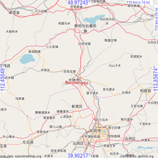
Beichengqu GPS coordinates[2]
40° 26' 21.984" North, 113° 9' 12.996" East
| Map corner | latitude | longitude |
|---|---|---|
| Upper-left | 40.97245°, | 112.45049° |
| Center: | 40.43944°, | 113.15361° |
| Lower-right: | 39.90217°, | 113.85674° |
| Map W x H: | 119×119 km | = 73.9×73.9mi |
| max Lat: | 53.31946° ⇑12.1% North |
| Beichengqu: | 40.43944° |
| min Lat: | ⇓87.9% South 18.22056° |
| min Long | Beichengqu | max Long |
| 75.07348° | 113.15361° | 134.28917° |
| W 43.4%⇐ | ⇒56.6% E |
Elevation
Elevation of Beichengqu is 1196 m = 3924 ft, and this is 711.2 m = 2333 ft above average elevation for this country.
| Max E: |
5622 m = 18445 ft | 11.9% |
| Beichengqu | 1196 m 3924 ft | |
| Avg. | 484.8 m = 1591 ft | |
Min E: |
-3 m = -10 ft | 88.1% |
See also: Beichengqu elevation on elevation.city.
Geographical zone
Beichengqu is located in North temperate zone (between Tropic of Cancer and the Arctic Circle). Distance of this Northern Tropic circle is 1890.5 km =1174.7 mi to South.| Distance of | km | miles | from Beichengqu |
|---|---|---|---|
| North Pole | 5510.6 | 3424.1 | to North |
| Arctic Circle | 2904.7 | 1804.9 | to North |
| Tropic Cancer | 1890.5 | 1174.7 | to South |
| Equator | 4496.4 | 2793.9 | to South |


Nearby cities:
15 places around Beichengqu: (largest is in red/bold)
• Beijiazao
50.6 km =31.4 mi,  148°
148°
• Datong
40.2 km =25 mi,  163°
163°
• Guanjiabao
36.7 km =22.8 mi,  218°
218°
• Jule
47 km =29.2 mi,  130°
130°
• Kouquan
49.1 km =30.5 mi,  180°
180°
• Longquan
44.2 km =27.5 mi,  100°
100°
• Majunying
39.2 km =24.4 mi,  171°
171°
• Que’ershan
39.8 km =24.7 mi,  206°
206°
• Santun
52.9 km =32.9 mi, 224°
• Togrog Ul
38.9 km =24.2 mi,  6°
6°
• Xihanling
47.8 km =29.7 mi, 171°
• Xinrong
20.2 km =12.6 mi, 184°
• Ya’erya
54.1 km =33.6 mi,  194°
194°
• Zhangjiachang
48.1 km =29.9 mi, 214°
• Zhoushizhuang
44.9 km =27.9 mi,  143°
143°
Sources, notices
• [Note1] Compared only with cities in China existing in our database
• [Src1] Map data: © OpenStreetMap contributors (CC-BY-SA)
• [Src2] Other city data from geonames.org with taken over terms of usage.
• [Src3] Geographical zone / Annual Mean Temperature by Robert A. Rohde @ Wikipedia
