Benhong geodata
Benhong (Inner Mongolia) is a seat of a fourth-order administrative division; located in China in Asia/Shanghai (GMT+8) time zone. In our database, there are 1268 cities with bigger population. Compared to other cities in China, 89.8% of cities are located further ↓South; 56% of cities are located further →East and 91.2% of cities have lower elevation than Benhong. Note1


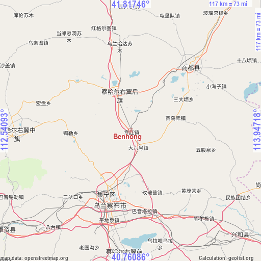
Benhong GPS coordinates[2]
41° 17' 28.68" North, 113° 14' 38.58" East
| Map corner | latitude | longitude |
|---|---|---|
| Upper-left | 41.81746°, | 112.54093° |
| Center: | 41.2913°, | 113.24405° |
| Lower-right: | 40.76086°, | 113.94718° |
| Map W x H: | 117.5×117.5 km | = 73×73mi |
| max Lat: | 53.31946° ⇑10.2% North |
| Benhong: | 41.2913° |
| min Lat: | ⇓89.8% South 18.22056° |
| min Long | Benhong | max Long |
| 75.07348° | 113.24405° | 134.28917° |
| W 44%⇐ | ⇒56% E |
Elevation
Elevation of Benhong is 1480 m = 4856 ft, and this is 995.2 m = 3265 ft above average elevation for this country.
| Max E: |
5622 m = 18445 ft | 8.8% |
| Benhong | 1480 m 4856 ft | |
| Avg. | 484.8 m = 1591 ft | |
Min E: |
-3 m = -10 ft | 91.2% |
See also: China elevation on elevation.city.
Geographical zone
Benhong is located in North temperate zone (between Tropic of Cancer and the Arctic Circle). Distance of this Northern Tropic circle is 1985.2 km =1233.5 mi to South.| Distance of | km | miles | from Benhong |
|---|---|---|---|
| North Pole | 5415.9 | 3365.3 | to North |
| Arctic Circle | 2810 | 1746.1 | to North |
| Tropic Cancer | 1985.2 | 1233.5 | to South |
| Equator | 4591.2 | 2852.8 | to South |


Nearby cities:
15 places around Benhong: (largest is in red/bold)
• Baiyin Chagan
18.7 km =11.6 mi,  344°
344°
• Chahannao
47.5 km =29.5 mi,  318°
318°
• Daliuhao
8.2 km =5.1 mi,  151°
151°
• Hayan Hudong
17.9 km =11.1 mi,  16°
16°
• Hongge’ertu
45.5 km =28.3 mi,  350°
350°
• Hongpan
41 km =25.5 mi,  287°
287°
• Jining
31.5 km =19.6 mi,  201°
201°
• Qitai
37.5 km =23.3 mi,  40°
40°
• Sandaogou
50.6 km =31.4 mi,  281°
281°
• Shengli
35.3 km =21.9 mi,  244°
244°
• Shimenkou
10.2 km =6.3 mi,  27°
27°
• Shiyaogou
14.5 km =9 mi,  268°
268°
• Wulan Hada
38 km =23.6 mi, 352°
• Xilei
27 km =16.8 mi, 268°
• Yuanshanzi
44.2 km =27.5 mi, 271°
Sources, notices
• [Note1] Compared only with cities in China existing in our database
• [Src1] Map data: © OpenStreetMap contributors (CC-BY-SA)
• [Src2] Other city data from geonames.org with taken over terms of usage.
• [Src3] Geographical zone / Annual Mean Temperature by Robert A. Rohde @ Wikipedia
