Sugehe geodata
Sugehe (Inner Mongolia) is a seat of a fourth-order administrative division; located in China in Asia/Shanghai (GMT+8) time zone. In our database, there are 1268 cities with bigger population. Compared to other cities in China, 98.7% of cities are located further ↓South; 88.8% of cities are located further ←West and 82.4% of cities have lower elevation than Sugehe. Note1


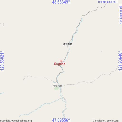
Sugehe GPS coordinates[2]
48° 10' 0.012" North, 121° 13' 59.988" East
| Map corner | latitude | longitude |
|---|---|---|
| Upper-left | 48.63349°, | 120.53021° |
| Center: | 48.16667°, | 121.23333° |
| Lower-right: | 47.69556°, | 121.93646° |
| Map W x H: | 104.3×104.3 km | = 64.8×64.8mi |
| max Lat: | 53.31946° ⇑1.3% North |
| Sugehe: | 48.16667° |
| min Lat: | ⇓98.7% South 18.22056° |
| min Long | Sugehe | max Long |
| 75.07348° | 121.23333° | 134.28917° |
| W 88.8%⇐ | ⇒11.2% E |
Elevation
Elevation of Sugehe is 813 m = 2667 ft, and this is 328.2 m = 1077 ft above average elevation for this country.
| Max E: |
5622 m = 18445 ft | 17.6% |
| Sugehe | 813 m 2667 ft | |
| Avg. | 484.8 m = 1591 ft | |
Min E: |
-3 m = -10 ft | 82.4% |
See also: China elevation on elevation.city.
Geographical zone
Sugehe is located in North temperate zone (between Tropic of Cancer and the Arctic Circle). Distance of this North polar circle is 2045.5 km =1271 mi to North.| Distance of | km | miles | from Sugehe |
|---|---|---|---|
| North Pole | 4651.4 | 2890.2 | to North |
| Arctic Circle | 2045.5 | 1271 | to North |
| Tropic Cancer | 2749.7 | 1708.6 | to South |
| Equator | 5355.6 | 3327.8 | to South |


Nearby cities:
15 places around Sugehe: (largest is in red/bold)
• Balin
82.5 km =51.3 mi,  78°
78°
• Boketu
82.5 km =51.3 mi,  37°
37°
• Chaihe
68.2 km =42.4 mi,  175°
175°
• Chuoyuan
16.4 km =10.2 mi,  21°
21°
• Elunchun Minzu
83.8 km =52.1 mi,  89°
89°
• Halasu
88.2 km =54.8 mi, 93°
• Haoraoshan
110.5 km =68.7 mi,  164°
164°
• Honghua’erji
93.6 km =58.2 mi,  277°
277°
• Mianduhe
104.8 km =65.1 mi,  351°
351°
• Samajie Ewenkeminzu
102.4 km =63.6 mi,  133°
133°
• Ta’erqi
21.1 km =13.1 mi,  187°
187°
• Woniuhe
106 km =65.9 mi, 93°
• Wunu’er
77.5 km =48.2 mi,  0°
0°
• Xinghua
110.1 km =68.4 mi,  98°
98°
• Ya’ergenchu
112.5 km =69.9 mi,  114°
114°
Sources, notices
• [Note1] Compared only with cities in China existing in our database
• [Src1] Map data: © OpenStreetMap contributors (CC-BY-SA)
• [Src2] Other city data from geonames.org with taken over terms of usage.
• [Src3] Geographical zone / Annual Mean Temperature by Robert A. Rohde @ Wikipedia
