Chaihe geodata
Chaihe (Inner Mongolia) is a seat of a fourth-order administrative division; located in China in Asia/Shanghai (GMT+8) time zone. In our database, there are 1268 cities with bigger population. Compared to other cities in China, 98% of cities are located further ↓South; 89.1% of cities are located further ←West and 77.8% of cities have lower elevation than Chaihe. Note1


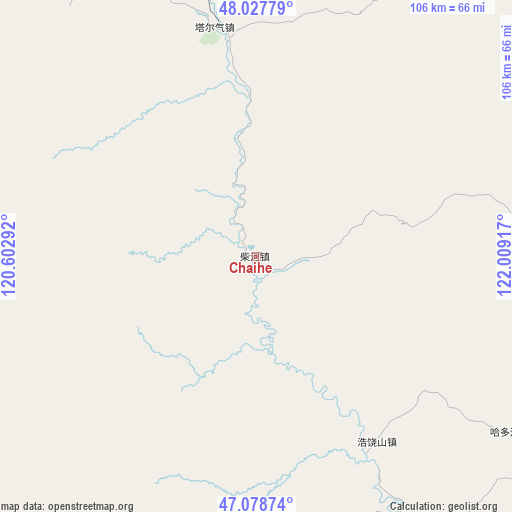
Chaihe GPS coordinates[2]
47° 33' 19.476" North, 121° 18' 21.744" East
| Map corner | latitude | longitude |
|---|---|---|
| Upper-left | 48.02779°, | 120.60292° |
| Center: | 47.55541°, | 121.30604° |
| Lower-right: | 47.07874°, | 122.00917° |
| Map W x H: | 105.5×105.5 km | = 65.6×65.6mi |
| max Lat: | 53.31946° ⇑2% North |
| Chaihe: | 47.55541° |
| min Lat: | ⇓98% South 18.22056° |
| min Long | Chaihe | max Long |
| 75.07348° | 121.30604° | 134.28917° |
| W 89.1%⇐ | ⇒10.9% E |
Elevation
Elevation of Chaihe is 605 m = 1985 ft, and this is 120.2 m = 394 ft above average elevation for this country.
| Max E: |
5622 m = 18445 ft | 22.2% |
| Chaihe | 605 m 1985 ft | |
| Avg. | 484.8 m = 1591 ft | |
Min E: |
-3 m = -10 ft | 77.8% |
See also: China elevation on elevation.city.
Geographical zone
Chaihe is located in North temperate zone (between Tropic of Cancer and the Arctic Circle). Distance of this North polar circle is 2113.5 km =1313.3 mi to North.| Distance of | km | miles | from Chaihe |
|---|---|---|---|
| North Pole | 4719.4 | 2932.5 | to North |
| Arctic Circle | 2113.5 | 1313.3 | to North |
| Tropic Cancer | 2681.7 | 1666.3 | to South |
| Equator | 5287.7 | 3285.6 | to South |


Nearby cities:
15 places around Chaihe: (largest is in red/bold)
• Chuoyuan
83.2 km =51.7 mi,  0°
0°
• Elunchun Minzu
104.6 km =65 mi,  48°
48°
• Guanmenshan
79.2 km =49.2 mi,  103°
103°
• Haduohe
63.9 km =39.7 mi,  124°
124°
• Halasu
103.6 km =64.4 mi, 53°
• Haoraoshan
45.7 km =28.4 mi,  147°
147°
• Moguqi
80.3 km =49.9 mi,  94°
94°
• Samajie Ewenkeminzu
69.1 km =42.9 mi, 92°
• Sugehe
68.2 km =42.4 mi,  355°
355°
• Ta’erqi
47.7 km =29.6 mi,  350°
350°
• Wadi
73.4 km =45.6 mi, 115°
• Wenquan
109 km =67.7 mi,  247°
247°
• Xinlin
91.7 km =57 mi,  111°
111°
• Ya’ergenchu
99.8 km =62 mi,  77°
77°
• Zhonghe
98.4 km =61.1 mi, 82°
Sources, notices
• [Note1] Compared only with cities in China existing in our database
• [Src1] Map data: © OpenStreetMap contributors (CC-BY-SA)
• [Src2] Other city data from geonames.org with taken over terms of usage.
• [Src3] Geographical zone / Annual Mean Temperature by Robert A. Rohde @ Wikipedia
