Shimen geodata
Shimen (Jilin) is a seat of a fourth-order administrative division; located in China in Asia/Shanghai (GMT+8) time zone. In our database, there are 1268 cities with bigger population. Compared to other cities in China, 92% of cities are located further ↓South; 98.4% of cities are located further ←West and 63.9% of cities have lower elevation than Shimen. Note1


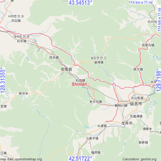
Shimen GPS coordinates[2]
43° 1' 59.988" North, 129° 1' 0.012" East
| Map corner | latitude | longitude |
|---|---|---|
| Upper-left | 43.54513°, | 128.31355° |
| Center: | 43.03333°, | 129.01667° |
| Lower-right: | 42.51722°, | 129.7198° |
| Map W x H: | 114.3×114.3 km | = 71×71mi |
| max Lat: | 53.31946° ⇑8% North |
| Shimen: | 43.03333° |
| min Lat: | ⇓92% South 18.22056° |
| min Long | Shimen | max Long |
| 75.07348° | 129.01667° | 134.28917° |
| W 98.4%⇐ | ⇒1.6% E |
Elevation
Elevation of Shimen is 309 m = 1014 ft, and this is 175.8 m = 577 ft below average elevation for this country.
| Max E: |
5622 m = 18445 ft | 36.1% |
| Avg. | 484.8 m = 1591 ft | |
| Shimen | 309 m = 1014 ft | |
Min E: |
-3 m = -10 ft | 63.9% |
See also: China elevation on elevation.city.
Geographical zone
Shimen is located in North temperate zone (between Tropic of Cancer and the Arctic Circle). Distance of this Northern Tropic circle is 2178.9 km =1353.9 mi to South.| Distance of | km | miles | from Shimen |
|---|---|---|---|
| North Pole | 5222.2 | 3244.9 | to North |
| Arctic Circle | 2616.3 | 1625.7 | to North |
| Tropic Cancer | 2178.9 | 1353.9 | to South |
| Equator | 4784.9 | 2973.2 | to South |


Nearby cities:
15 places around Shimen: (largest is in red/bold)
• Bajiazi
41.6 km =25.8 mi,  169°
169°
• Beixinjie
35 km =21.7 mi,  154°
154°
• Changxing
17.7 km =11 mi,  338°
338°
• Chaoyangchuan
32.8 km =20.4 mi,  121°
121°
• Erdao
37.9 km =23.5 mi, 170°
• Jiulong
41.5 km =25.8 mi,  78°
78°
• Liangbing
25.2 km =15.7 mi,  311°
311°
• Mingyue
11.2 km =7 mi,  316°
316°
• Pucheng
40.8 km =25.4 mi,  142°
142°
• Sandaowan
19.5 km =12.1 mi,  41°
41°
• Shiqi
40.7 km =25.3 mi,  257°
257°
• Tongfosi
24.5 km =15.2 mi,  131°
131°
• Xiaoying
43.2 km =26.8 mi,  108°
108°
• Xilinhe
24.7 km =15.3 mi, 152°
• Yanji
42.3 km =26.3 mi, 109°
Sources, notices
• [Note1] Compared only with cities in China existing in our database
• [Src1] Map data: © OpenStreetMap contributors (CC-BY-SA)
• [Src2] Other city data from geonames.org with taken over terms of usage.
• [Src3] Geographical zone / Annual Mean Temperature by Robert A. Rohde @ Wikipedia
