Shanshi geodata
Shanshi (Heilongjiang) is a seat of a fourth-order administrative division; located in China in Asia/Shanghai (GMT+8) time zone. In our database, there are 1268 cities with bigger population. Compared to other cities in China, 93.5% of cities are located further ↓South; 98.5% of cities are located further ←West and 63.5% of cities have lower elevation than Shanshi. Note1


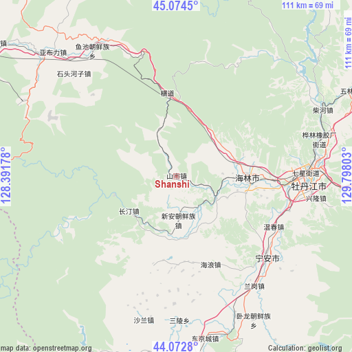
Shanshi GPS coordinates[2]
44° 34' 32.916" North, 129° 5' 41.64" East
| Map corner | latitude | longitude |
|---|---|---|
| Upper-left | 45.0745°, | 128.39178° |
| Center: | 44.57581°, | 129.0949° |
| Lower-right: | 44.0728°, | 129.79803° |
| Map W x H: | 111.4×111.4 km | = 69.2×69.2mi |
| max Lat: | 53.31946° ⇑6.5% North |
| Shanshi: | 44.57581° |
| min Lat: | ⇓93.5% South 18.22056° |
| min Long | Shanshi | max Long |
| 75.07348° | 129.0949° | 134.28917° |
| W 98.5%⇐ | ⇒1.5% E |
Elevation
Elevation of Shanshi is 304 m = 997 ft, and this is 180.8 m = 593 ft below average elevation for this country.
| Max E: |
5622 m = 18445 ft | 36.5% |
| Avg. | 484.8 m = 1591 ft | |
| Shanshi | 304 m = 997 ft | |
Min E: |
-3 m = -10 ft | 63.5% |
See also: China elevation on elevation.city.
Geographical zone
Shanshi is located in North temperate zone (between Tropic of Cancer and the Arctic Circle). Distance of this Northern Tropic circle is 2350.4 km =1460.5 mi to South.| Distance of | km | miles | from Shanshi |
|---|---|---|---|
| North Pole | 5050.7 | 3138.4 | to North |
| Arctic Circle | 2444.8 | 1519.1 | to North |
| Tropic Cancer | 2350.4 | 1460.5 | to South |
| Equator | 4956.4 | 3079.8 | to South |


Nearby cities:
15 places around Shanshi: (largest is in red/bold)
• Bei’an
38.6 km =24 mi,  81°
81°
• Changting
18.3 km =11.4 mi,  229°
229°
• Fanjia
37 km =23 mi,  126°
126°
• Hailang
29.9 km =18.6 mi,  158°
158°
• Hailin
23 km =14.3 mi,  91°
91°
• Hainan
31.4 km =19.5 mi, 92°
• Hengdaohezi
25.9 km =16.1 mi,  355°
355°
• Jiujie
20.8 km =12.9 mi,  181°
181°
• Ning’an
39.1 km =24.3 mi, 131°
• Shihe
14.7 km =9.1 mi,  118°
118°
• Wenchun
35.1 km =21.8 mi, 117°
• Xiangyang
38.4 km =23.9 mi, 87°
• Xinghua
39.8 km =24.7 mi,  172°
172°
• Xin’an
17.4 km =10.8 mi, 173°
• Yanjiang
38.3 km =23.8 mi, 91°
Sources, notices
• [Note1] Compared only with cities in China existing in our database
• [Src1] Map data: © OpenStreetMap contributors (CC-BY-SA)
• [Src2] Other city data from geonames.org with taken over terms of usage.
• [Src3] Geographical zone / Annual Mean Temperature by Robert A. Rohde @ Wikipedia
