Xinghua geodata
Xinghua (Heilongjiang) is a seat of a fourth-order administrative division; located in China in Asia/Shanghai (GMT+8) time zone. In our database, there are 1268 cities with bigger population. Compared to other cities in China, 93.1% of cities are located further ↓South; 98.5% of cities are located further ←West and 63.9% of cities have lower elevation than Xinghua. Note1


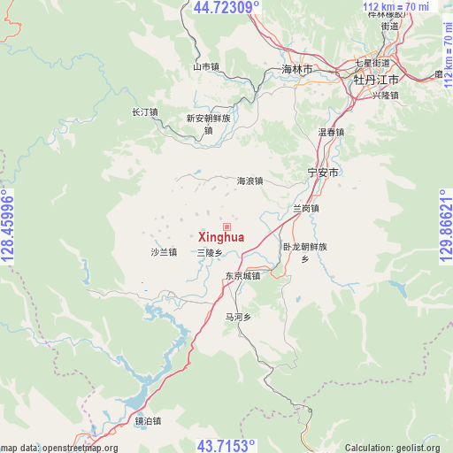
Xinghua GPS coordinates[2]
44° 13' 16.86" North, 129° 9' 47.088" East
| Map corner | latitude | longitude |
|---|---|---|
| Upper-left | 44.72309°, | 128.45996° |
| Center: | 44.22135°, | 129.16308° |
| Lower-right: | 43.7153°, | 129.86621° |
| Map W x H: | 112.1×112.1 km | = 69.7×69.7mi |
| max Lat: | 53.31946° ⇑6.9% North |
| Xinghua: | 44.22135° |
| min Lat: | ⇓93.1% South 18.22056° |
| min Long | Xinghua | max Long |
| 75.07348° | 129.16308° | 134.28917° |
| W 98.5%⇐ | ⇒1.5% E |
Elevation
Elevation of Xinghua is 309 m = 1014 ft, and this is 175.8 m = 577 ft below average elevation for this country.
| Max E: |
5622 m = 18445 ft | 36.1% |
| Avg. | 484.8 m = 1591 ft | |
| Xinghua | 309 m = 1014 ft | |
Min E: |
-3 m = -10 ft | 63.9% |
See also: China elevation on elevation.city.
Geographical zone
Xinghua is located in North temperate zone (between Tropic of Cancer and the Arctic Circle). Distance of this Northern Tropic circle is 2311 km =1436 mi to South.| Distance of | km | miles | from Xinghua |
|---|---|---|---|
| North Pole | 5090.1 | 3162.8 | to North |
| Arctic Circle | 2484.2 | 1543.6 | to North |
| Tropic Cancer | 2311 | 1436 | to South |
| Equator | 4917 | 3055.3 | to South |


Nearby cities:
15 places around Xinghua: (largest is in red/bold)
• Bohai
11.7 km =7.3 mi,  185°
185°
• Dongjingcheng
12.5 km =7.8 mi,  162°
162°
• Fanjia
30 km =18.6 mi,  54°
54°
• Hailang
12.9 km =8 mi,  25°
25°
• Jiujie
19.6 km =12.2 mi,  341°
341°
• Langang
20 km =12.4 mi,  76°
76°
• Mahe
19.6 km =12.2 mi,  174°
174°
• Ning’an
27.7 km =17.2 mi,  60°
60°
• Ping’an
10.6 km =6.6 mi,  97°
97°
• Sanling
7.5 km =4.7 mi,  215°
215°
• Shalan
16.9 km =10.5 mi,  248°
248°
• Shihe
33.2 km =20.6 mi,  13°
13°
• Shiyan
14.6 km =9.1 mi,  109°
109°
• Wolong
20.3 km =12.6 mi, 107°
• Xin’an
22.4 km =13.9 mi,  351°
351°
Sources, notices
• [Note1] Compared only with cities in China existing in our database
• [Src1] Map data: © OpenStreetMap contributors (CC-BY-SA)
• [Src2] Other city data from geonames.org with taken over terms of usage.
• [Src3] Geographical zone / Annual Mean Temperature by Robert A. Rohde @ Wikipedia
