Hengdaohezi geodata
Hengdaohezi (Heilongjiang) is a seat of a fourth-order administrative division; located in China in Asia/Shanghai (GMT+8) time zone. In our database, there are 1268 cities with bigger population. Compared to other cities in China, 93.7% of cities are located further ↓South; 98.4% of cities are located further ←West and 70.6% of cities have lower elevation than Hengdaohezi. Note1


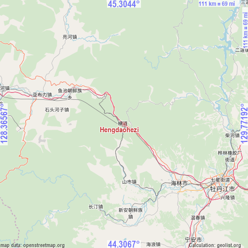
Hengdaohezi GPS coordinates[2]
44° 48' 27.756" North, 129° 4' 7.644" East
| Map corner | latitude | longitude |
|---|---|---|
| Upper-left | 45.3044°, | 128.36567° |
| Center: | 44.80771°, | 129.06879° |
| Lower-right: | 44.3067°, | 129.77192° |
| Map W x H: | 110.9×110.9 km | = 68.9×68.9mi |
| max Lat: | 53.31946° ⇑6.3% North |
| Hengdaohezi: | 44.80771° |
| min Lat: | ⇓93.7% South 18.22056° |
| min Long | Hengdaohezi | max Long |
| 75.07348° | 129.06879° | 134.28917° |
| W 98.4%⇐ | ⇒1.6% E |
Elevation
Elevation of Hengdaohezi is 422 m = 1385 ft, and this is 62.8 m = 206 ft below average elevation for this country.
| Max E: |
5622 m = 18445 ft | 29.4% |
| Avg. | 484.8 m = 1591 ft | |
| Hengdaohezi | 422 m = 1385 ft | |
Min E: |
-3 m = -10 ft | 70.6% |
See also: China elevation on elevation.city.
Geographical zone
Hengdaohezi is located in North temperate zone (between Tropic of Cancer and the Arctic Circle). Distance of this Northern Tropic circle is 2376.2 km =1476.5 mi to South.| Distance of | km | miles | from Hengdaohezi |
|---|---|---|---|
| North Pole | 5024.9 | 3122.3 | to North |
| Arctic Circle | 2419 | 1503.1 | to North |
| Tropic Cancer | 2376.2 | 1476.5 | to South |
| Equator | 4982.2 | 3095.8 | to South |


Nearby cities:
15 places around Hengdaohezi: (largest is in red/bold)
• Bei’an
45 km =28 mi,  116°
116°
• Chaihe
48.4 km =30.1 mi,  96°
96°
• Changting
39.5 km =24.5 mi,  197°
197°
• Hailin
36.3 km =22.6 mi,  136°
136°
• Hainan
43 km =26.7 mi,  129°
129°
• Jiujie
46.6 km =29 mi,  178°
178°
• Lianghe
46.1 km =28.6 mi,  328°
328°
• Shanshi
25.9 km =16.1 mi, 175°
• Shihe
36.1 km =22.4 mi,  155°
155°
• Shitouhezi
31 km =19.3 mi,  282°
282°
• Xiangyang
47.2 km =29.3 mi, 121°
• Xin’an
43.2 km =26.8 mi,  174°
174°
• Yabuli
38.7 km =24 mi,  290°
290°
• Yanjiang
48.3 km =30 mi, 123°
• Yuchi
27.8 km =17.3 mi,  299°
299°
Sources, notices
• [Note1] Compared only with cities in China existing in our database
• [Src1] Map data: © OpenStreetMap contributors (CC-BY-SA)
• [Src2] Other city data from geonames.org with taken over terms of usage.
• [Src3] Geographical zone / Annual Mean Temperature by Robert A. Rohde @ Wikipedia
