Shaguotun geodata
Shaguotun (Liaoning) is a seat of a fourth-order administrative division; located in China in Asia/Shanghai (GMT+8) time zone. In our database, there are 1268 cities with bigger population. Compared to other cities in China, 89.4% of cities are located further ↓South; 86.2% of cities are located further ←West and 55.7% of cities have higher elevation than Shaguotun. Note1


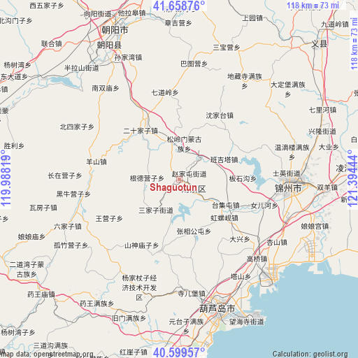
Shaguotun GPS coordinates[2]
41° 7' 52.68" North, 120° 41' 28.716" East
| Map corner | latitude | longitude |
|---|---|---|
| Upper-left | 41.65876°, | 119.98819° |
| Center: | 41.1313°, | 120.69131° |
| Lower-right: | 40.59957°, | 121.39444° |
| Map W x H: | 117.8×117.8 km | = 73.2×73.2mi |
| max Lat: | 53.31946° ⇑10.6% North |
| Shaguotun: | 41.1313° |
| min Lat: | ⇓89.4% South 18.22056° |
| min Long | Shaguotun | max Long |
| 75.07348° | 120.69131° | 134.28917° |
| W 86.2%⇐ | ⇒13.8% E |
Elevation
Elevation of Shaguotun is 126 m = 413 ft, and this is 358.8 m = 1177 ft below average elevation for this country.
| Max E: |
5622 m = 18445 ft | 55.7% |
| Avg. | 484.8 m = 1591 ft | |
| Shaguotun | 126 m = 413 ft | |
Min E: |
-3 m = -10 ft | 44.3% |
See also: China elevation on elevation.city.
Geographical zone
Shaguotun is located in North temperate zone (between Tropic of Cancer and the Arctic Circle). Distance of this Northern Tropic circle is 1967.5 km =1222.5 mi to South.| Distance of | km | miles | from Shaguotun |
|---|---|---|---|
| North Pole | 5433.7 | 3376.3 | to North |
| Arctic Circle | 2827.8 | 1757.1 | to North |
| Tropic Cancer | 1967.5 | 1222.5 | to South |
| Equator | 4573.4 | 2841.8 | to South |


Nearby cities:
15 places around Shaguotun: (largest is in red/bold)
• Baimashi
37.3 km =23.2 mi,  230°
230°
• Daxing
28 km =17.4 mi,  131°
131°
• Gangtun
24.3 km =15.1 mi,  194°
194°
• Gaoqiao
36.4 km =22.6 mi,  135°
135°
• Heiiyugou
38.2 km =23.7 mi,  197°
197°
• Jinzhou
37.8 km =23.5 mi,  93°
93°
• Maoqitun
38.2 km =23.7 mi, 198°
• Nanpiao
6 km =3.7 mi, 127°
• Nuanchitang
11.7 km =7.3 mi, 191°
• Shaheying
34.6 km =21.5 mi,  169°
169°
• Shanxi
24.8 km =15.4 mi,  210°
210°
• Si’erbao
37.4 km =23.2 mi, 173°
• Taijitun
17.2 km =10.7 mi,  118°
118°
• Wanghu
23.7 km =14.7 mi, 116°
• Yingta
37.8 km =23.5 mi,  147°
147°
Sources, notices
• [Note1] Compared only with cities in China existing in our database
• [Src1] Map data: © OpenStreetMap contributors (CC-BY-SA)
• [Src2] Other city data from geonames.org with taken over terms of usage.
• [Src3] Geographical zone / Annual Mean Temperature by Robert A. Rohde @ Wikipedia
