Qidaogou geodata
Qidaogou (Jilin) is a seat of a fourth-order administrative division; located in China in Asia/Shanghai (GMT+8) time zone. In our database, there are 1268 cities with bigger population. Compared to other cities in China, 90.2% of cities are located further ↓South; 95.9% of cities are located further ←West and 77.9% of cities have lower elevation than Qidaogou. Note1


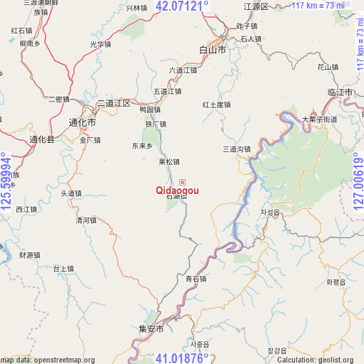
Qidaogou GPS coordinates[2]
41° 32' 49.668" North, 126° 18' 11.016" East
| Map corner | latitude | longitude |
|---|---|---|
| Upper-left | 42.07121°, | 125.59994° |
| Center: | 41.54713°, | 126.30306° |
| Lower-right: | 41.01876°, | 127.00619° |
| Map W x H: | 117×117 km | = 72.7×72.7mi |
| max Lat: | 53.31946° ⇑9.8% North |
| Qidaogou: | 41.54713° |
| min Lat: | ⇓90.2% South 18.22056° |
| min Long | Qidaogou | max Long |
| 75.07348° | 126.30306° | 134.28917° |
| W 95.9%⇐ | ⇒4.1% E |
Elevation
Elevation of Qidaogou is 610 m = 2001 ft, and this is 125.2 m = 411 ft above average elevation for this country.
| Max E: |
5622 m = 18445 ft | 22.1% |
| Qidaogou | 610 m 2001 ft | |
| Avg. | 484.8 m = 1591 ft | |
Min E: |
-3 m = -10 ft | 77.9% |
See also: China elevation on elevation.city.
Geographical zone
Qidaogou is located in North temperate zone (between Tropic of Cancer and the Arctic Circle). Distance of this Northern Tropic circle is 2013.7 km =1251.3 mi to South.| Distance of | km | miles | from Qidaogou |
|---|---|---|---|
| North Pole | 5387.5 | 3347.6 | to North |
| Arctic Circle | 2781.6 | 1728.4 | to North |
| Tropic Cancer | 2013.7 | 1251.3 | to South |
| Equator | 4619.6 | 2870.5 | to South |


Nearby cities:
15 places around Qidaogou: (largest is in red/bold)
• Baishan
44.6 km =27.7 mi,  12°
12°
• Dajinggou
39.6 km =24.6 mi,  27°
27°
• Da’an
35.2 km =21.9 mi,  335°
335°
• Donglai
17.6 km =10.9 mi,  311°
311°
• Erdaojiang
34 km =21.1 mi,  318°
318°
• Gongyi
4.6 km =2.9 mi,  204°
204°
• Huangbai
31.2 km =19.4 mi,  172°
172°
• Hulutao
40.7 km =25.3 mi, 312°
• Liudaogou
8 km =5 mi,  328°
328°
• Qinghe
33.4 km =20.8 mi,  248°
248°
• Qingshi
27.2 km =16.9 mi,  140°
140°
• Sandaogou
20.6 km =12.8 mi,  57°
57°
• Tonghua
36.7 km =22.8 mi,  301°
301°
• Toudao
36.1 km =22.4 mi,  263°
263°
• Weishahe
42.6 km =26.5 mi, 60°
Sources, notices
• [Note1] Compared only with cities in China existing in our database
• [Src1] Map data: © OpenStreetMap contributors (CC-BY-SA)
• [Src2] Other city data from geonames.org with taken over terms of usage.
• [Src3] Geographical zone / Annual Mean Temperature by Robert A. Rohde @ Wikipedia
