Luhe geodata
Luhe (Heilongjiang) is a seat of a fourth-order administrative division; located in China in Asia/Shanghai (GMT+8) time zone. In our database, there are 1268 cities with bigger population. Compared to other cities in China, 96% of cities are located further ↓South; 95.7% of cities are located further ←West and 55.2% of cities have lower elevation than Luhe. Note1


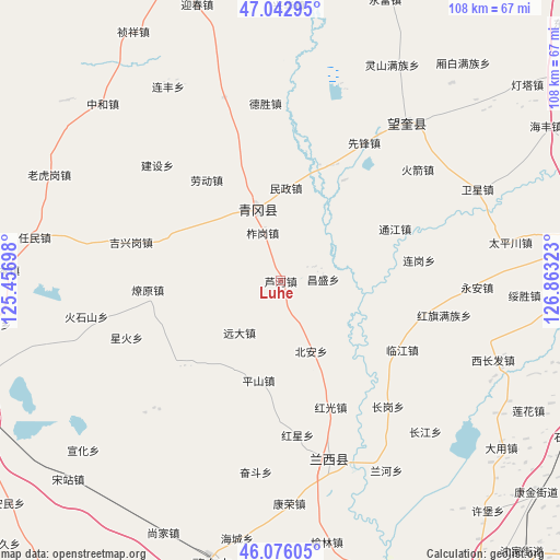
Luhe GPS coordinates[2]
46° 33' 41.94" North, 126° 9' 36.36" East
| Map corner | latitude | longitude |
|---|---|---|
| Upper-left | 47.04295°, | 125.45698° |
| Center: | 46.56165°, | 126.1601° |
| Lower-right: | 46.07605°, | 126.86323° |
| Map W x H: | 107.5×107.5 km | = 66.8×66.8mi |
| max Lat: | 53.31946° ⇑4% North |
| Luhe: | 46.56165° |
| min Lat: | ⇓96% South 18.22056° |
| min Long | Luhe | max Long |
| 75.07348° | 126.1601° | 134.28917° |
| W 95.7%⇐ | ⇒4.3% E |
Elevation
Elevation of Luhe is 208 m = 682 ft, and this is 276.8 m = 908 ft below average elevation for this country.
| Max E: |
5622 m = 18445 ft | 44.8% |
| Avg. | 484.8 m = 1591 ft | |
| Luhe | 208 m = 682 ft | |
Min E: |
-3 m = -10 ft | 55.2% |
See also: China elevation on elevation.city.
Geographical zone
Luhe is located in North temperate zone (between Tropic of Cancer and the Arctic Circle). Distance of this North polar circle is 2224 km =1381.9 mi to North.| Distance of | km | miles | from Luhe |
|---|---|---|---|
| North Pole | 4829.9 | 3001.2 | to North |
| Arctic Circle | 2224 | 1381.9 | to North |
| Tropic Cancer | 2571.3 | 1597.7 | to South |
| Equator | 5177.2 | 3217 | to South |


Nearby cities:
15 places around Luhe: (largest is in red/bold)
• Bei’an
14.7 km =9.1 mi,  155°
155°
• Changsheng
8.2 km =5.1 mi,  87°
87°
• Hongguang
26.1 km =16.2 mi, 158°
• Hongxing
29.9 km =18.6 mi,  173°
173°
• Jixinggang
29.5 km =18.3 mi,  284°
284°
• Laodong
27.7 km =17.2 mi,  320°
320°
• Liaoyuan
25.5 km =15.8 mi,  265°
265°
• Linjiang
27 km =16.8 mi,  119°
119°
• Minzheng
17.7 km =11 mi,  3°
3°
• Pingshan
19.6 km =12.2 mi,  192°
192°
• Qinggang
14.3 km =8.9 mi,  343°
343°
• Tongjiang
24.3 km =15.1 mi,  65°
65°
• Xinghuo
31.7 km =19.7 mi,  249°
249°
• Yuanda
12.9 km =8 mi,  219°
219°
• Zhagang
9.8 km =6.1 mi, 340°
Sources, notices
• [Note1] Compared only with cities in China existing in our database
• [Src1] Map data: © OpenStreetMap contributors (CC-BY-SA)
• [Src2] Other city data from geonames.org with taken over terms of usage.
• [Src3] Geographical zone / Annual Mean Temperature by Robert A. Rohde @ Wikipedia
