Liaoyuan geodata
Liaoyuan (Heilongjiang) is a seat of a fourth-order administrative division; located in China in Asia/Shanghai (GMT+8) time zone. In our database, there are 1268 cities with bigger population. Compared to other cities in China, 96% of cities are located further ↓South; 95.3% of cities are located further ←West and 53.5% of cities have lower elevation than Liaoyuan. Note1


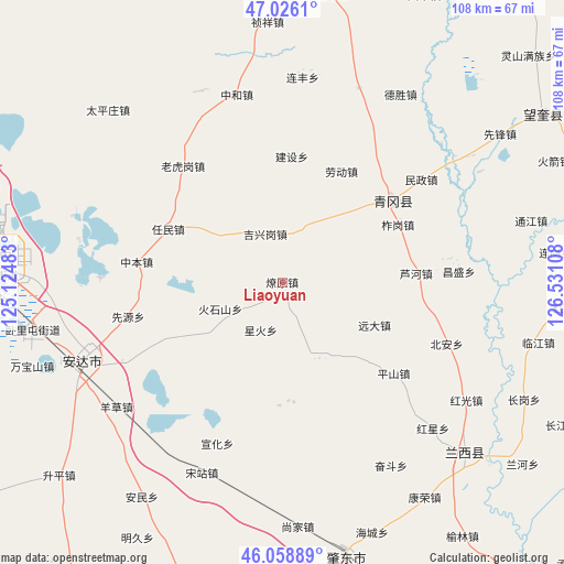
Liaoyuan GPS coordinates[2]
46° 32' 40.74" North, 125° 49' 40.62" East
| Map corner | latitude | longitude |
|---|---|---|
| Upper-left | 47.0261°, | 125.12483° |
| Center: | 46.54465°, | 125.82795° |
| Lower-right: | 46.05889°, | 126.53108° |
| Map W x H: | 107.5×107.5 km | = 66.8×66.8mi |
| max Lat: | 53.31946° ⇑4% North |
| Liaoyuan: | 46.54465° |
| min Lat: | ⇓96% South 18.22056° |
| min Long | Liaoyuan | max Long |
| 75.07348° | 125.82795° | 134.28917° |
| W 95.3%⇐ | ⇒4.7% E |
Elevation
Elevation of Liaoyuan is 193 m = 633 ft, and this is 291.8 m = 957 ft below average elevation for this country.
| Max E: |
5622 m = 18445 ft | 46.5% |
| Avg. | 484.8 m = 1591 ft | |
| Liaoyuan | 193 m = 633 ft | |
Min E: |
-3 m = -10 ft | 53.5% |
See also: China elevation on elevation.city.
Geographical zone
Liaoyuan is located in North temperate zone (between Tropic of Cancer and the Arctic Circle). Distance of this North polar circle is 2225.9 km =1383.1 mi to North.| Distance of | km | miles | from Liaoyuan |
|---|---|---|---|
| North Pole | 4831.8 | 3002.3 | to North |
| Arctic Circle | 2225.9 | 1383.1 | to North |
| Tropic Cancer | 2569.4 | 1596.6 | to South |
| Equator | 5175.3 | 3215.8 | to South |


Nearby cities:
15 places around Liaoyuan: (largest is in red/bold)
• Huoshishan
12.7 km =7.9 mi,  247°
247°
• Jianshe
24 km =14.9 mi,  3°
3°
• Jixinggang
9.7 km =6 mi,  340°
340°
• Laodong
24.7 km =15.3 mi,  18°
18°
• Laohugang
29.1 km =18.1 mi,  319°
319°
• Luhe
25.5 km =15.8 mi,  85°
85°
• Minzheng
32.9 km =20.4 mi,  53°
53°
• Pingshan
27.3 km =17 mi,  129°
129°
• Qinggang
26.3 km =16.3 mi, 53°
• Renmin
24 km =14.9 mi,  294°
294°
• Xianyuan
30 km =18.6 mi,  257°
257°
• Xinghuo
10 km =6.2 mi,  205°
205°
• Yuanda
19 km =11.8 mi,  115°
115°
• Zhagang
24.7 km =15.3 mi,  63°
63°
• Zhongben
28 km =17.4 mi,  278°
278°
Sources, notices
• [Note1] Compared only with cities in China existing in our database
• [Src1] Map data: © OpenStreetMap contributors (CC-BY-SA)
• [Src2] Other city data from geonames.org with taken over terms of usage.
• [Src3] Geographical zone / Annual Mean Temperature by Robert A. Rohde @ Wikipedia
