Liushutun geodata
Liushutun (Liaoning) is a seat of a fourth-order administrative division; located in China in Asia/Shanghai (GMT+8) time zone. In our database, there are 1268 cities with bigger population. Compared to other cities in China, 91.4% of cities are located further ↓South; 92.7% of cities are located further ←West and 61.3% of cities have higher elevation than Liushutun. Note1


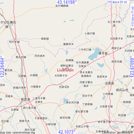
Liushutun GPS coordinates[2]
42° 37' 36.444" North, 122° 58' 3.936" East
| Map corner | latitude | longitude |
|---|---|---|
| Upper-left | 43.14198°, | 122.26464° |
| Center: | 42.62679°, | 122.96776° |
| Lower-right: | 42.1073°, | 123.67089° |
| Map W x H: | 115×115 km | = 71.5×71.5mi |
| max Lat: | 53.31946° ⇑8.6% North |
| Liushutun: | 42.62679° |
| min Lat: | ⇓91.4% South 18.22056° |
| min Long | Liushutun | max Long |
| 75.07348° | 122.96776° | 134.28917° |
| W 92.7%⇐ | ⇒7.3% E |
Elevation
Elevation of Liushutun is 91 m = 299 ft, and this is 393.8 m = 1292 ft below average elevation for this country.
| Max E: |
5622 m = 18445 ft | 61.3% |
| Avg. | 484.8 m = 1591 ft | |
| Liushutun | 91 m = 299 ft | |
Min E: |
-3 m = -10 ft | 38.7% |
See also: China elevation on elevation.city.
Geographical zone
Liushutun is located in North temperate zone (between Tropic of Cancer and the Arctic Circle). Distance of this Northern Tropic circle is 2133.7 km =1325.8 mi to South.| Distance of | km | miles | from Liushutun |
|---|---|---|---|
| North Pole | 5267.4 | 3273 | to North |
| Arctic Circle | 2661.5 | 1653.8 | to North |
| Tropic Cancer | 2133.7 | 1325.8 | to South |
| Equator | 4739.7 | 2945.1 | to South |


Nearby cities:
15 places around Liushutun: (largest is in red/bold)
• Beisijiazi
49 km =30.4 mi,  59°
59°
• Dasijiazi
56.5 km =35.1 mi,  75°
75°
• Dongguantun
32 km =19.9 mi, 76°
• Dongsheng
13.6 km =8.5 mi, 77°
• Erniusuokou
21.8 km =13.5 mi,  44°
44°
• Guyushu
60.2 km =37.4 mi,  89°
89°
• Haizhouwobao
47.8 km =29.7 mi, 43°
• Haoguantun
42.8 km =26.6 mi, 82°
• Kangping
33.6 km =20.9 mi,  68°
68°
• Laowobao
57.2 km =35.5 mi,  53°
53°
• Liangjiazi
45.5 km =28.3 mi, 68°
• Xiaochengzi
35.1 km =21.8 mi,  33°
33°
• Xiguantun Muguzu Manzuxiang
17.2 km =10.7 mi,  109°
109°
• Xizhahaqi
8.6 km =5.3 mi,  309°
309°
• Zhangqiang
6.6 km =4.1 mi,  17°
17°
Sources, notices
• [Note1] Compared only with cities in China existing in our database
• [Src1] Map data: © OpenStreetMap contributors (CC-BY-SA)
• [Src2] Other city data from geonames.org with taken over terms of usage.
• [Src3] Geographical zone / Annual Mean Temperature by Robert A. Rohde @ Wikipedia
