Xizhahaqi geodata
Xizhahaqi (Liaoning) is a seat of a fourth-order administrative division; located in China in Asia/Shanghai (GMT+8) time zone. In our database, there are 1268 cities with bigger population. Compared to other cities in China, 91.6% of cities are located further ↓South; 92.6% of cities are located further ←West and 54.8% of cities have higher elevation than Xizhahaqi. Note1


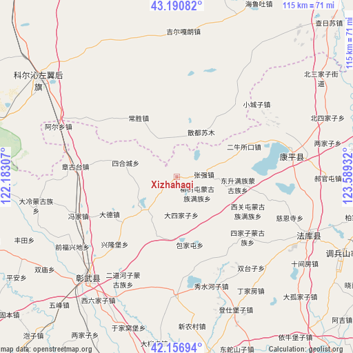
Xizhahaqi GPS coordinates[2]
42° 40' 33.708" North, 122° 53' 10.284" East
| Map corner | latitude | longitude |
|---|---|---|
| Upper-left | 43.19082°, | 122.18307° |
| Center: | 42.67603°, | 122.88619° |
| Lower-right: | 42.15694°, | 123.58932° |
| Map W x H: | 115×115 km | = 71.5×71.5mi |
| max Lat: | 53.31946° ⇑8.4% North |
| Xizhahaqi: | 42.67603° |
| min Lat: | ⇓91.6% South 18.22056° |
| min Long | Xizhahaqi | max Long |
| 75.07348° | 122.88619° | 134.28917° |
| W 92.6%⇐ | ⇒7.4% E |
Elevation
Elevation of Xizhahaqi is 133 m = 436 ft, and this is 351.8 m = 1154 ft below average elevation for this country.
| Max E: |
5622 m = 18445 ft | 54.8% |
| Avg. | 484.8 m = 1591 ft | |
| Xizhahaqi | 133 m = 436 ft | |
Min E: |
-3 m = -10 ft | 45.2% |
See also: China elevation on elevation.city.
Geographical zone
Xizhahaqi is located in North temperate zone (between Tropic of Cancer and the Arctic Circle). Distance of this Northern Tropic circle is 2139.2 km =1329.2 mi to South.| Distance of | km | miles | from Xizhahaqi |
|---|---|---|---|
| North Pole | 5261.9 | 3269.6 | to North |
| Arctic Circle | 2656 | 1650.4 | to North |
| Tropic Cancer | 2139.2 | 1329.2 | to South |
| Equator | 4745.1 | 2948.5 | to South |


Nearby cities:
15 places around Xizhahaqi: (largest is in red/bold)
• Beisijiazi
52.6 km =32.7 mi,  68°
68°
• Dasijiazi
62 km =38.5 mi,  81°
81°
• Dongguantun
37.9 km =23.5 mi,  87°
87°
• Dongsheng
20.2 km =12.6 mi,  97°
97°
• Erniusuokou
24.1 km =15 mi, 65°
• Guyushu
67.1 km =41.7 mi, 94°
• Haizhouwobao
49.1 km =30.5 mi,  53°
53°
• Haoguantun
49.1 km =30.5 mi, 90°
• Kangping
38.5 km =23.9 mi, 79°
• Laowobao
59.9 km =37.2 mi,  61°
61°
• Liangjiazi
50.2 km =31.2 mi, 76°
• Liushutun
8.6 km =5.3 mi,  129°
129°
• Xiaochengzi
35.2 km =21.9 mi, 47°
• Xiguantun Muguzu Manzuxiang
25.4 km =15.8 mi,  116°
116°
• Zhangqiang
8.6 km =5.3 mi, 84°
Sources, notices
• [Note1] Compared only with cities in China existing in our database
• [Src1] Map data: © OpenStreetMap contributors (CC-BY-SA)
• [Src2] Other city data from geonames.org with taken over terms of usage.
• [Src3] Geographical zone / Annual Mean Temperature by Robert A. Rohde @ Wikipedia
