Kaiyuan geodata
Kaiyuan (Liaoning) is a populated place; located in China in Asia/Shanghai (GMT+8) time zone. With population of 112,462 people, there are 388 cities with bigger population in this country. Compared to other cities in China, 91.4% of cities are located further ↓South; 93.8% of cities are located further ←West and 61.3% of cities have higher elevation than Kaiyuan. Note1


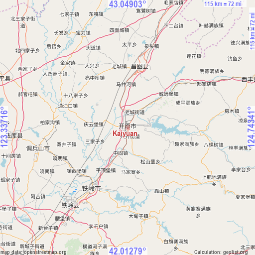
Kaiyuan GPS coordinates[2]
42° 31' 59.016" North, 124° 2' 25.008" East
| Map corner | latitude | longitude |
|---|---|---|
| Upper-left | 43.04903°, | 123.33716° |
| Center: | 42.53306°, | 124.04028° |
| Lower-right: | 42.01279°, | 124.74341° |
| Map W x H: | 115.2×115.2 km | = 71.6×71.6mi |
| max Lat: | 53.31946° ⇑8.6% North |
| Kaiyuan: | 42.53306° |
| min Lat: | ⇓91.4% South 18.22056° |
| min Long | Kaiyuan | max Long |
| 75.07348° | 124.04028° | 134.28917° |
| W 93.8%⇐ | ⇒6.2% E |
Elevation
Elevation of Kaiyuan is 91 m = 299 ft, and this is 393.8 m = 1292 ft below average elevation for this country.
| Max E: |
5622 m = 18445 ft | 61.3% |
| Avg. | 484.8 m = 1591 ft | |
| Kaiyuan | 91 m = 299 ft | |
Min E: |
-3 m = -10 ft | 38.7% |
See also: Kaiyuan elevation on elevation.city.
Geographical zone
Kaiyuan is located in North temperate zone (between Tropic of Cancer and the Arctic Circle). Distance of this Northern Tropic circle is 2123.3 km =1319.4 mi to South.| Distance of | km | miles | from Kaiyuan |
|---|---|---|---|
| North Pole | 5277.8 | 3279.5 | to North |
| Arctic Circle | 2671.9 | 1660.2 | to North |
| Tropic Cancer | 2123.3 | 1319.4 | to South |
| Equator | 4729.2 | 2938.6 | to South |


Nearby cities:
15 places around Kaiyuan: (largest is in red/bold)
• Changtu
27.7 km =17.2 mi,  9°
9°
• Dasijiazi
41.3 km =25.7 mi,  306°
306°
• Daxing
32.5 km =20.2 mi,  330°
330°
• Ertaizi
37.8 km =23.5 mi,  1°
1°
• Guyushu
29.5 km =18.3 mi,  290°
290°
• Haoguantun
47.9 km =29.8 mi, 289°
• Jinjia
40.5 km =25.2 mi,  317°
317°
• Laocheng
28.1 km =17.5 mi,  352°
352°
• Liangjiazi
52.9 km =32.9 mi,  301°
301°
• Mazhonghe
20.2 km =12.6 mi,  356°
356°
• Quantou
38.4 km =23.9 mi,  16°
16°
• Shibajiazi
27.7 km =17.2 mi, 302°
• Tieling
31.3 km =19.4 mi,  211°
211°
• Xia’ertai
50.6 km =31.4 mi, 23°
• Yongfeng
27.8 km =17.3 mi, 325°
Sources, notices
• [Note1] Compared only with cities in China existing in our database
• [Src1] Map data: © OpenStreetMap contributors (CC-BY-SA)
• [Src2] Other city data from geonames.org with taken over terms of usage.
• [Src3] Geographical zone / Annual Mean Temperature by Robert A. Rohde @ Wikipedia
