Jiguan geodata
Jiguan (Jilin) is a seat of a fourth-order administrative division; located in China in Asia/Shanghai (GMT+8) time zone. In our database, there are 1268 cities with bigger population. Compared to other cities in China, 92.3% of cities are located further ↓South; 99.1% of cities are located further ←West and 65.4% of cities have lower elevation than Jiguan. Note1


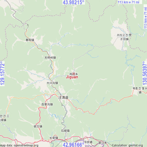
Jiguan GPS coordinates[2]
43° 28' 26.616" North, 129° 51' 39.024" East
| Map corner | latitude | longitude |
|---|---|---|
| Upper-left | 43.98215°, | 129.15772° |
| Center: | 43.47406°, | 129.86084° |
| Lower-right: | 42.96166°, | 130.56397° |
| Map W x H: | 113.5×113.5 km | = 70.5×70.5mi |
| max Lat: | 53.31946° ⇑7.7% North |
| Jiguan: | 43.47406° |
| min Lat: | ⇓92.3% South 18.22056° |
| min Long | Jiguan | max Long |
| 75.07348° | 129.86084° | 134.28917° |
| W 99.1%⇐ | ⇒0.90000000000001% E |
Elevation
Elevation of Jiguan is 333 m = 1093 ft, and this is 151.8 m = 498 ft below average elevation for this country.
| Max E: |
5622 m = 18445 ft | 34.6% |
| Avg. | 484.8 m = 1591 ft | |
| Jiguan | 333 m = 1093 ft | |
Min E: |
-3 m = -10 ft | 65.4% |
See also: China elevation on elevation.city.
Geographical zone
Jiguan is located in North temperate zone (between Tropic of Cancer and the Arctic Circle). Distance of this Northern Tropic circle is 2227.9 km =1384.4 mi to South.| Distance of | km | miles | from Jiguan |
|---|---|---|---|
| North Pole | 5173.2 | 3214.5 | to North |
| Arctic Circle | 2567.3 | 1595.2 | to North |
| Tropic Cancer | 2227.9 | 1384.4 | to South |
| Equator | 4833.9 | 3003.6 | to South |


Nearby cities:
15 places around Jiguan: (largest is in red/bold)
• Baicaogou
31.2 km =19.4 mi,  221°
221°
• Chang’an
52.1 km =32.4 mi,  197°
197°
• Chunyang
43.4 km =27 mi,  307°
307°
• Daxinggou
17.7 km =11 mi,  245°
245°
• Dongguang
20.8 km =12.9 mi,  191°
191°
• Hamatang
29.7 km =18.5 mi,  259°
259°
• Jincang
51.5 km =32 mi,  103°
103°
• Jiulong
49.4 km =30.7 mi,  214°
214°
• Luozigou
47.9 km =29.8 mi,  53°
53°
• Mijiang
57.8 km =35.9 mi,  156°
156°
• Sandaowan
65.3 km =40.6 mi,  238°
238°
• Shixian
44.1 km =27.4 mi, 189°
• Tianqiaoling
22.7 km =14.1 mi,  304°
304°
• Tumen
56.5 km =35.1 mi,  181°
181°
• Wangqing
18.7 km =11.6 mi, 204°
Sources, notices
• [Note1] Compared only with cities in China existing in our database
• [Src1] Map data: © OpenStreetMap contributors (CC-BY-SA)
• [Src2] Other city data from geonames.org with taken over terms of usage.
• [Src3] Geographical zone / Annual Mean Temperature by Robert A. Rohde @ Wikipedia
