Chunyang geodata
Chunyang (Jilin) is a seat of a fourth-order administrative division; located in China in Asia/Shanghai (GMT+8) time zone. In our database, there are 1268 cities with bigger population. Compared to other cities in China, 92.4% of cities are located further ↓South; 98.7% of cities are located further ←West and 66.9% of cities have lower elevation than Chunyang. Note1


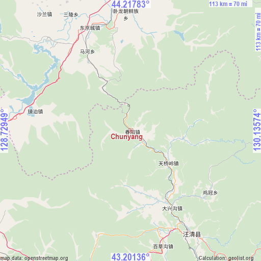
Chunyang GPS coordinates[2]
43° 42' 42.3" North, 129° 25' 57.396" East
| Map corner | latitude | longitude |
|---|---|---|
| Upper-left | 44.21783°, | 128.72949° |
| Center: | 43.71175°, | 129.43261° |
| Lower-right: | 43.20136°, | 130.13574° |
| Map W x H: | 113×113 km | = 70.2×70.2mi |
| max Lat: | 53.31946° ⇑7.6% North |
| Chunyang: | 43.71175° |
| min Lat: | ⇓92.4% South 18.22056° |
| min Long | Chunyang | max Long |
| 75.07348° | 129.43261° | 134.28917° |
| W 98.7%⇐ | ⇒1.3% E |
Elevation
Elevation of Chunyang is 358 m = 1175 ft, and this is 126.8 m = 416 ft below average elevation for this country.
| Max E: |
5622 m = 18445 ft | 33.1% |
| Avg. | 484.8 m = 1591 ft | |
| Chunyang | 358 m = 1175 ft | |
Min E: |
-3 m = -10 ft | 66.9% |
See also: China elevation on elevation.city.
Geographical zone
Chunyang is located in North temperate zone (between Tropic of Cancer and the Arctic Circle). Distance of this Northern Tropic circle is 2254.4 km =1400.8 mi to South.| Distance of | km | miles | from Chunyang |
|---|---|---|---|
| North Pole | 5146.8 | 3198.1 | to North |
| Arctic Circle | 2540.9 | 1578.8 | to North |
| Tropic Cancer | 2254.4 | 1400.8 | to South |
| Equator | 4860.3 | 3020 | to South |


Nearby cities:
15 places around Chunyang: (largest is in red/bold)
• Baicaogou
51.5 km =32 mi,  164°
164°
• Bohai
50.4 km =31.3 mi,  333°
333°
• Daxinggou
38.5 km =23.9 mi,  151°
151°
• Dongguang
55.7 km =34.6 mi, 147°
• Dongjingcheng
48.2 km =30 mi,  338°
338°
• Hamatang
32.5 km =20.2 mi,  170°
170°
• Jiguan
43.4 km =27 mi,  127°
127°
• Mahe
42 km =26.1 mi, 332°
• Ping’an
56.3 km =35 mi,  348°
348°
• Sanling
56.8 km =35.3 mi, 332°
• Shiyan
52.3 km =32.5 mi, 351°
• Tianqiaoling
20.8 km =12.9 mi, 130°
• Wangqing
50.9 km =31.6 mi, 148°
• Wolong
50.5 km =31.4 mi,  357°
357°
• Xinghua
60.6 km =37.7 mi, 339°
Sources, notices
• [Note1] Compared only with cities in China existing in our database
• [Src1] Map data: © OpenStreetMap contributors (CC-BY-SA)
• [Src2] Other city data from geonames.org with taken over terms of usage.
• [Src3] Geographical zone / Annual Mean Temperature by Robert A. Rohde @ Wikipedia
