Guzhuyingzi geodata
Guzhuyingzi (Liaoning) is a seat of a fourth-order administrative division; located in China in Asia/Shanghai (GMT+8) time zone. In our database, there are 1268 cities with bigger population. Compared to other cities in China, 89.1% of cities are located further ↓South; 83.7% of cities are located further ←West and 62.2% of cities have lower elevation than Guzhuyingzi. Note1


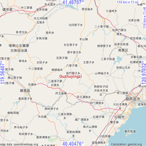
Guzhuyingzi GPS coordinates[2]
40° 56' 16.98" North, 120° 16' 1.884" East
| Map corner | latitude | longitude |
|---|---|---|
| Upper-left | 41.46707°, | 119.56407° |
| Center: | 40.93805°, | 120.26719° |
| Lower-right: | 40.40476°, | 120.97032° |
| Map W x H: | 118.1×118.1 km | = 73.4×73.4mi |
| max Lat: | 53.31946° ⇑10.9% North |
| Guzhuyingzi: | 40.93805° |
| min Lat: | ⇓89.1% South 18.22056° |
| min Long | Guzhuyingzi | max Long |
| 75.07348° | 120.26719° | 134.28917° |
| W 83.7%⇐ | ⇒16.3% E |
Elevation
Elevation of Guzhuyingzi is 286 m = 938 ft, and this is 198.8 m = 652 ft below average elevation for this country.
| Max E: |
5622 m = 18445 ft | 37.8% |
| Avg. | 484.8 m = 1591 ft | |
| Guzhuyingzi | 286 m = 938 ft | |
Min E: |
-3 m = -10 ft | 62.2% |
See also: China elevation on elevation.city.
Geographical zone
Guzhuyingzi is located in North temperate zone (between Tropic of Cancer and the Arctic Circle). Distance of this Northern Tropic circle is 1946 km =1209.2 mi to South.| Distance of | km | miles | from Guzhuyingzi |
|---|---|---|---|
| North Pole | 5455.2 | 3389.7 | to North |
| Arctic Circle | 2849.3 | 1770.5 | to North |
| Tropic Cancer | 1946 | 1209.2 | to South |
| Equator | 4551.9 | 2828.4 | to South |


Nearby cities:
15 places around Guzhuyingzi: (largest is in red/bold)
• Baimashi
7.4 km =4.6 mi,  109°
109°
• Gangtun
29.5 km =18.3 mi,  93°
93°
• Heiiyugou
28.3 km =17.6 mi,  121°
121°
• Huludao
52.1 km =32.4 mi, 113°
• Kuanbang
49.4 km =30.7 mi,  194°
194°
• Maoqitun
27.6 km =17.1 mi, 122°
• Nanpiao
44.1 km =27.4 mi,  66°
66°
• Nuanchitang
34.8 km =21.6 mi, 73°
• Shaguotun
41.6 km =25.8 mi,  58°
58°
• Shaheying
43.6 km =27.1 mi, 106°
• Shanxi
23.2 km =14.4 mi, 90°
• Si’erbao
42.6 km =26.5 mi, 111°
• Taijitun
52.5 km =32.6 mi,  75°
75°
• Xingcheng
52 km =32.3 mi,  133°
133°
• Xintaimen
17.1 km =10.6 mi, 132°
Sources, notices
• [Note1] Compared only with cities in China existing in our database
• [Src1] Map data: © OpenStreetMap contributors (CC-BY-SA)
• [Src2] Other city data from geonames.org with taken over terms of usage.
• [Src3] Geographical zone / Annual Mean Temperature by Robert A. Rohde @ Wikipedia
