Gubeikou geodata
Gubeikou (Beijing) is a seat of a fourth-order administrative division; located in China in Asia/Shanghai (GMT+8) time zone. In our database, there are 1268 cities with bigger population. Compared to other cities in China, 88.5% of cities are located further ↓South; 66.8% of cities are located further ←West and 56% of cities have lower elevation than Gubeikou. Note1


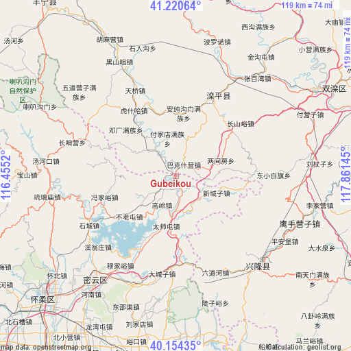
Gubeikou GPS coordinates[2]
40° 41' 22.668" North, 117° 9' 29.952" East
| Map corner | latitude | longitude |
|---|---|---|
| Upper-left | 41.22064°, | 116.4552° |
| Center: | 40.68963°, | 117.15832° |
| Lower-right: | 40.15435°, | 117.86145° |
| Map W x H: | 118.6×118.6 km | = 73.7×73.7mi |
| max Lat: | 53.31946° ⇑11.5% North |
| Gubeikou: | 40.68963° |
| min Lat: | ⇓88.5% South 18.22056° |
| min Long | Gubeikou | max Long |
| 75.07348° | 117.15832° | 134.28917° |
| W 66.8%⇐ | ⇒33.2% E |
Elevation
Elevation of Gubeikou is 216 m = 709 ft, and this is 268.8 m = 882 ft below average elevation for this country.
| Max E: |
5622 m = 18445 ft | 44% |
| Avg. | 484.8 m = 1591 ft | |
| Gubeikou | 216 m = 709 ft | |
Min E: |
-3 m = -10 ft | 56% |
See also: China elevation on elevation.city.
Geographical zone
Gubeikou is located in North temperate zone (between Tropic of Cancer and the Arctic Circle). Distance of this Northern Tropic circle is 1918.3 km =1192 mi to South.| Distance of | km | miles | from Gubeikou |
|---|---|---|---|
| North Pole | 5482.8 | 3406.9 | to North |
| Arctic Circle | 2876.9 | 1787.6 | to North |
| Tropic Cancer | 1918.3 | 1192 | to South |
| Equator | 4524.3 | 2811.3 | to South |


Nearby cities:
15 places around Gubeikou: (largest is in red/bold)
• Beizhuang
20.3 km =12.6 mi,  177°
177°
• Bulaotun
20.7 km =12.9 mi,  228°
228°
• Changshaoying
36.9 km =22.9 mi,  288°
288°
• Dachengzi
33.4 km =20.8 mi,  187°
187°
• Gaoling
10.7 km =6.6 mi,  204°
204°
• Jugezhuang
39 km =24.2 mi,  206°
206°
• Liulimiao
43.8 km =27.2 mi,  260°
260°
• Luanping
27.3 km =17 mi,  22°
22°
• Shicheng
33.5 km =20.8 mi,  240°
240°
• Taishitun
17.2 km =10.7 mi, 191°
• Tanghekou
44.2 km =27.5 mi,  276°
276°
• Xinchengzi
15 km =9.3 mi,  112°
112°
• Xinglong
42 km =26.1 mi,  135°
135°
• Xiwengzhuang
36.4 km =22.6 mi, 227°
• Zhenluoying
39 km =24.2 mi, 182°
Sources, notices
• [Note1] Compared only with cities in China existing in our database
• [Src1] Map data: © OpenStreetMap contributors (CC-BY-SA)
• [Src2] Other city data from geonames.org with taken over terms of usage.
• [Src3] Geographical zone / Annual Mean Temperature by Robert A. Rohde @ Wikipedia
