Luanping geodata
Luanping (Hebei) is a seat of a third-order administrative division; located in China in Asia/Shanghai (GMT+8) time zone. In our database, there are 1268 cities with bigger population. Compared to other cities in China, 89% of cities are located further ↓South; 67.7% of cities are located further ←West and 75.2% of cities have lower elevation than Luanping. Note1


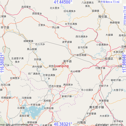
Luanping GPS coordinates[2]
40° 55' 0.012" North, 117° 16' 59.988" East
| Map corner | latitude | longitude |
|---|---|---|
| Upper-left | 41.44586°, | 116.58021° |
| Center: | 40.91667°, | 117.28333° |
| Lower-right: | 40.38321°, | 117.98646° |
| Map W x H: | 118.2×118.2 km | = 73.4×73.4mi |
| max Lat: | 53.31946° ⇑11% North |
| Luanping: | 40.91667° |
| min Lat: | ⇓89% South 18.22056° |
| min Long | Luanping | max Long |
| 75.07348° | 117.28333° | 134.28917° |
| W 67.7%⇐ | ⇒32.3% E |
Elevation
Elevation of Luanping is 526 m = 1726 ft, and this is 41.2 m = 135 ft above average elevation for this country.
| Max E: |
5622 m = 18445 ft | 24.8% |
| Luanping | 526 m 1726 ft | |
| Avg. | 484.8 m = 1591 ft | |
Min E: |
-3 m = -10 ft | 75.2% |
See also: China elevation on elevation.city.
Geographical zone
Luanping is located in North temperate zone (between Tropic of Cancer and the Arctic Circle). Distance of this Northern Tropic circle is 1943.6 km =1207.7 mi to South.| Distance of | km | miles | from Luanping |
|---|---|---|---|
| North Pole | 5457.6 | 3391.2 | to North |
| Arctic Circle | 2851.7 | 1772 | to North |
| Tropic Cancer | 1943.6 | 1207.7 | to South |
| Equator | 4549.5 | 2826.9 | to South |


Nearby cities:
15 places around Luanping: (largest is in red/bold)
• Beizhuang
46.5 km =28.9 mi,  192°
192°
• Bulaotun
46.8 km =29.1 mi,  213°
213°
• Changshaoying
47.5 km =29.5 mi,  253°
253°
• Chengde
56.9 km =35.4 mi,  86°
86°
• Gaoling
38.1 km =23.7 mi,  203°
203°
• Gubeikou
27.3 km =17 mi, 202°
• Laba Goumen
56.1 km =34.9 mi,  267°
267°
• Longhua
57.4 km =35.7 mi,  40°
40°
• Shicheng
57.6 km =35.8 mi,  223°
223°
• Shuangtashan
43.1 km =26.8 mi, 85°
• Taishitun
44.3 km =27.5 mi, 198°
• Tanghekou
58 km =36 mi, 249°
• Xinchengzi
31.1 km =19.3 mi,  173°
173°
• Xinglong
58.3 km =36.2 mi,  161°
161°
• Yingshouyingzi
51.6 km =32.1 mi,  141°
141°
Sources, notices
• [Note1] Compared only with cities in China existing in our database
• [Src1] Map data: © OpenStreetMap contributors (CC-BY-SA)
• [Src2] Other city data from geonames.org with taken over terms of usage.
• [Src3] Geographical zone / Annual Mean Temperature by Robert A. Rohde @ Wikipedia
