Changbai geodata
Changbai (Jilin) is a seat of a third-order administrative division; located in China in Asia/Shanghai (GMT+8) time zone. In our database, there are 1268 cities with bigger population. Compared to other cities in China, 90% of cities are located further ↓South; 98% of cities are located further ←West and 80.6% of cities have lower elevation than Changbai. Note1


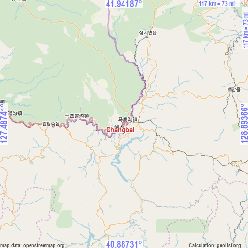
Changbai GPS coordinates[2]
41° 25' 0.228" North, 128° 11' 25.908" East
| Map corner | latitude | longitude |
|---|---|---|
| Upper-left | 41.94187°, | 127.48741° |
| Center: | 41.41673°, | 128.19053° |
| Lower-right: | 40.88731°, | 128.89366° |
| Map W x H: | 117.3×117.3 km | = 72.9×72.9mi |
| max Lat: | 53.31946° ⇑10% North |
| Changbai: | 41.41673° |
| min Lat: | ⇓90% South 18.22056° |
| min Long | Changbai | max Long |
| 75.07348° | 128.19053° | 134.28917° |
| W 98%⇐ | ⇒2% E |
Elevation
Elevation of Changbai is 722 m = 2369 ft, and this is 237.2 m = 778 ft above average elevation for this country.
| Max E: |
5622 m = 18445 ft | 19.4% |
| Changbai | 722 m 2369 ft | |
| Avg. | 484.8 m = 1591 ft | |
Min E: |
-3 m = -10 ft | 80.6% |
See also: China elevation on elevation.city.
Geographical zone
Changbai is located in North temperate zone (between Tropic of Cancer and the Arctic Circle). Distance of this Northern Tropic circle is 1999.2 km =1242.2 mi to South.| Distance of | km | miles | from Changbai |
|---|---|---|---|
| North Pole | 5402 | 3356.6 | to North |
| Arctic Circle | 2796.1 | 1737.4 | to North |
| Tropic Cancer | 1999.2 | 1242.2 | to South |
| Equator | 4605.1 | 2861.5 | to South |


Nearby cities:
15 places around Changbai: (largest is in red/bold)
• Badaogou
77.9 km =48.4 mi,  278°
278°
• Baoquanshan
62.1 km =38.6 mi, 280°
• Baoshan
78.2 km =48.6 mi,  286°
286°
• Chongshan
100.8 km =62.6 mi,  41°
41°
• Dongbeicha
83.1 km =51.6 mi,  295°
295°
• Jiajiaying
93 km =57.8 mi, 296°
• Jinhua
13.6 km =8.5 mi, 275°
• Liudaogou
86.1 km =53.5 mi, 284°
• Manjiang
77.2 km =48 mi,  319°
319°
• Mayihe
99.9 km =62.1 mi, 296°
• Shisandaogou
34.4 km =21.4 mi,  272°
272°
• Shisidaogou
22.7 km =14.1 mi, 279°
• Shi’erdaogou
54.1 km =33.6 mi, 275°
• Xinfangzi
70.8 km =44 mi, 282°
• Xinxigang
99.9 km =62.1 mi, 316°
In other languages:
- In Chinese: Ch’ang-pai-chen, Ch’ang-pai-ch’ao-hsien-tsu-tzu-chih-hsien, Ch’ang-pai-hsien, 长白
Sources, notices
• [Note1] Compared only with cities in China existing in our database
• [Src1] Map data: © OpenStreetMap contributors (CC-BY-SA)
• [Src2] Other city data from geonames.org with taken over terms of usage.
• [Src3] Geographical zone / Annual Mean Temperature by Robert A. Rohde @ Wikipedia
