Dongzhou geodata
Dongzhou (Liaoning) is a seat of a fourth-order administrative division; located in China in Asia/Shanghai (GMT+8) time zone. In our database, there are 1268 cities with bigger population. Compared to other cities in China, 90.8% of cities are located further ↓South; 93.8% of cities are located further ←West and 60.3% of cities have higher elevation than Dongzhou. Note1


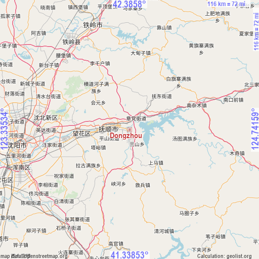
Dongzhou GPS coordinates[2]
41° 51' 51.516" North, 124° 2' 18.456" East
| Map corner | latitude | longitude |
|---|---|---|
| Upper-left | 42.3858°, | 123.33534° |
| Center: | 41.86431°, | 124.03846° |
| Lower-right: | 41.33853°, | 124.74159° |
| Map W x H: | 116.4×116.4 km | = 72.3×72.3mi |
| max Lat: | 53.31946° ⇑9.2% North |
| Dongzhou: | 41.86431° |
| min Lat: | ⇓90.8% South 18.22056° |
| min Long | Dongzhou | max Long |
| 75.07348° | 124.03846° | 134.28917° |
| W 93.8%⇐ | ⇒6.2% E |
Elevation
Elevation of Dongzhou is 97 m = 318 ft, and this is 387.8 m = 1272 ft below average elevation for this country.
| Max E: |
5622 m = 18445 ft | 60.3% |
| Avg. | 484.8 m = 1591 ft | |
| Dongzhou | 97 m = 318 ft | |
Min E: |
-3 m = -10 ft | 39.7% |
See also: China elevation on elevation.city.
Geographical zone
Dongzhou is located in North temperate zone (between Tropic of Cancer and the Arctic Circle). Distance of this Northern Tropic circle is 2049 km =1273.2 mi to South.| Distance of | km | miles | from Dongzhou |
|---|---|---|---|
| North Pole | 5352.2 | 3325.7 | to North |
| Arctic Circle | 2746.3 | 1706.5 | to North |
| Tropic Cancer | 2049 | 1273.2 | to South |
| Equator | 4654.9 | 2892.4 | to South |


Nearby cities:
15 places around Dongzhou: (largest is in red/bold)
• Dongling
38.7 km =24 mi,  261°
261°
• Fushun
8.2 km =5.1 mi,  287°
287°
• Hada
14.7 km =9.1 mi,  35°
35°
• Hongtoushan
41.3 km =25.7 mi,  69°
69°
• Hou’an
23 km =14.3 mi,  140°
140°
• Jiubing
25.4 km =15.8 mi,  166°
166°
• Lanshan
8.6 km =5.3 mi,  147°
147°
• Nanzamu
33 km =20.5 mi, 69°
• Nianpan
4.8 km =3 mi,  180°
180°
• Qiandian
4.5 km =2.8 mi,  318°
318°
• Shangjiahe
37 km =23 mi,  92°
92°
• Shangma
13.1 km =8.1 mi,  134°
134°
• Tangtu
25.1 km =15.6 mi,  99°
99°
• Zhangdang
5.6 km =3.5 mi,  31°
31°
• Zhangdian
5.2 km =3.2 mi, 177°
Sources, notices
• [Note1] Compared only with cities in China existing in our database
• [Src1] Map data: © OpenStreetMap contributors (CC-BY-SA)
• [Src2] Other city data from geonames.org with taken over terms of usage.
• [Src3] Geographical zone / Annual Mean Temperature by Robert A. Rohde @ Wikipedia
